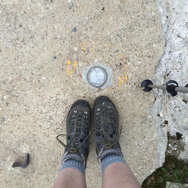
A while back we hiked Middle & South Carter in the beautiful White Mountains of New Hampshire but couldn’t do Carter Dome because my pup hurt her little paw pads. This past weekend we took a break from house stuff to finish the Carters. I now only have five mountains left to finish the 48 4000 footers in the Whites!! Woo! I have to hike the Bonds which is 3 peaks, Isolation, and Owls Head to finish up.
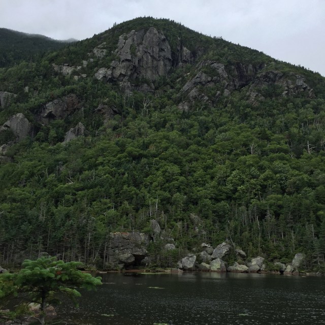
Mizpah playing in the 19 Mile BrookThe main building at the Carter Notch HutCarter Pond…check out that cloud creeping upAnother Carter Pond shotLooking down into the notch at the Carter Notch Hut. Those rocks down there look small, but they are the size of buildings!Looking out into the Wild River Wilderness from a view before the summitMizpah ascending into the cloud
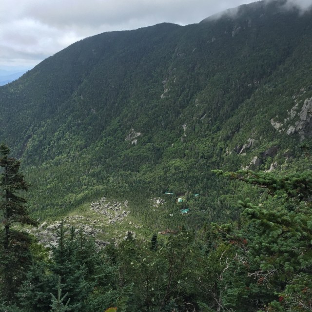
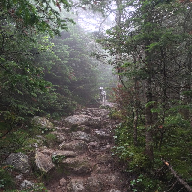
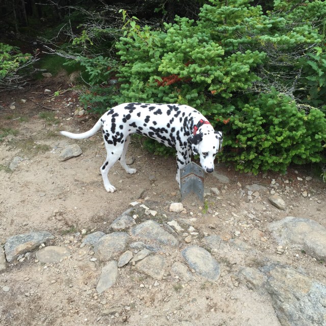
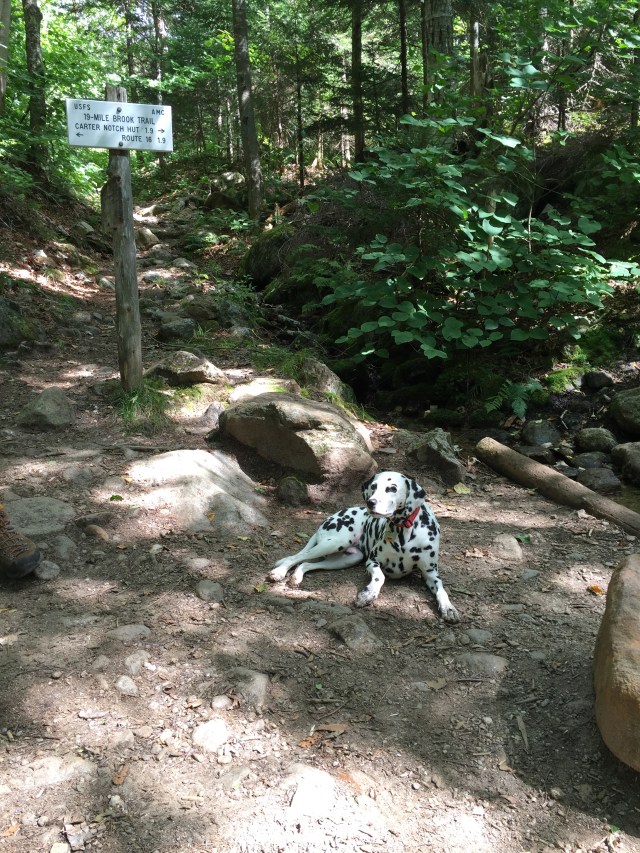
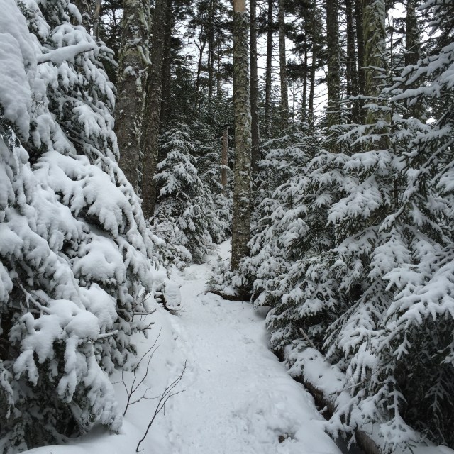
We went up 19 Mile Brook Trail to the Carter-Moriah Trail which has some steep parts to the summit. The Carter Notch Hut is off the Carter-Moriah Trail. This particular hut has different buildings for the bathroom, bunks, and dining area whereas a hut like the Mizpah Spring Hut has everything in just one building. The summit has the remnants of a tower which is cool even though it doesn’t have great views. We were in a cloud the day I hiked though so there were no views no matter what.
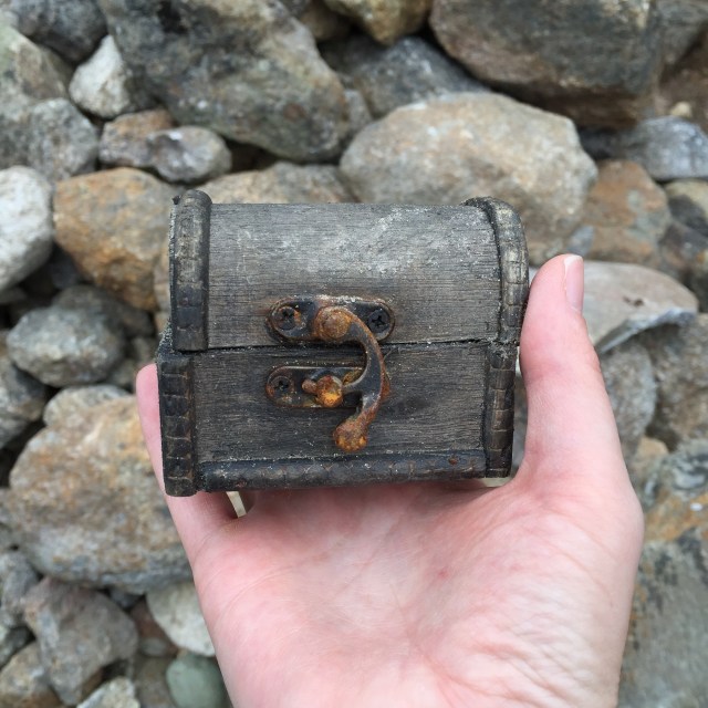
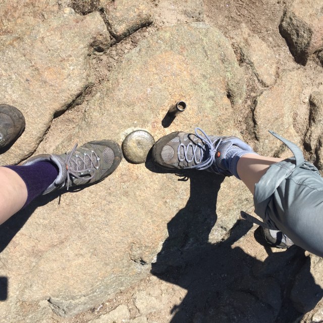
We thought this was a geocache in the rocks of this cairn near the summit, but the note inside was actually a very sweet memorial tribute 🙂My trusty La Sportiva Pamirs….these are my zombie apocalypse footwear….yes we have discussed what footwear we would grab for a zombie apocalypse.Summit!In a cloud on the summit!Mizpah investigating one of the old anchors for the tower that is no longer up there
We took the Carter Dome Trail back down to the 19 Mile Brook Trail which is a little longer, but not as steep. I would MUCH rather go up something steep and come down something more gradual for my knees’s sake. It’s better for Mizpah’s joints too!!
Yep, we handfeed Mizpah her food out on the trail. She never eats breakfast before we leave for a hike, so anytime we take a break, we offer her food to keep up her energy!Mizpah lounging trailsideLove the scenery on the 19 Mile Brook Trail!
It was a really great hike to do after taking a little time off. We even ran into one of my favorite instagrammers out on the trail- @munjoyboy. He was coming down Carter-Moriah as we were heading up. He has AMAZING photos of many of my favorite places.
Last week, I got to do a midweek hike with my sister who is just starting out doing the 4,000 footers in NH. We did Mt. Jackson and Mt. Pierce, which are the most southern 4,000 footers in the Presidential Range. This was actually my third time hiking these two, but first time in the summer!
We took the Webster-Jackson Trail from Rt. 302 to Mt. Jackson, and then the Webster Cliff Trail over to Mt. Pierce, and finally the Crawford Path back down to Rt. 302. It was my first 4000 footer hike without my husband, and so I felt a little pressure to make sure we were on the correct trails, going the right way and so on. Mt. Webster is up there too, named after Daniel Webster, but it’s not a 4000 footer so we had to make sure we avoided that trail.
Mt. Jackson is actually not named after Andrew Jackson, our 7th president. It is named after Charles Jackson who was a physician and the state’s geologist! On the way to Mt. Pierce, named for Franklin Pierce, is the Appalachian Mountain Club (AMC) run Mizpah Spring Hut. It was a really nice one. It made me miss my pup, Mizpah, but her paw pads were still healing.
View down from Mt. Jackson. You can just barely see the Mt. Washington Hotel down there! Just to the right of center with that red roof!Sisters at the summit!The rest of the Presidentials from Jackson, you can see Washington perfectly high up on the right!Mizpah Spring Hut, just below the summit of Mt. PierceThe Mizpah bell in the hut, reminded me of my pup!Matching Merrell boots up on top of Mt. Pierce! Mine on the left are just really old haha. Mt. Pierce was originally named Mt. Clinton after DeWitt Clinton, a governor of NH.Just starting out on the Crawford Path, beautiful views of the PresisSomeone on the trail got really excited about my mountain hat, said he was friends with one of the Harding Lane guys! We probably could have had a nice convo if I wasn’t so awkward and unable to speak more than “hi, how are you, have a nice hike” haha
The Crawford family….you really can’t discuss the history of the White Mountains without talking about a few families, and the Crawford’s are definitely one. Abel and Ethan were father and son. They cleared a path up from Rt 302 to Mt. Pierce (Clinton then) over to Mt. Washington and guided hikers up. Abel at 75 years old in 1840 ascended this trail to Mt. Washington on horseback!! The path is just over 8 miles and goes over Mt. Eisenhower, Mt. Monroe, past the Lake in the Clouds, and ends up at Mt. Washington’s summit.
It was a really hot day which meant drinking lots of water. Having the hut was nice to fill up and not have to worry about running out of water. When we finished our hike, we headed to the Woodstock Inn Station & Brewery for a beer and some food. So delicious. I got the chicken salad melt which is an open faced sandwich on their spent grain bread, and my sister got a bison bacon bbq burger. We both got their summer beer which is deliciously light and refreshing. It was just a great day with my sister, so thankful to be able to hike with her!
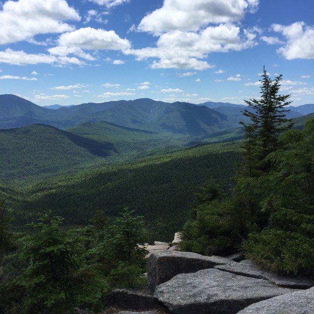
We stayed at the Mt. Washington Hotel last week for a few days, and of course had to do a hike while we were there. The trailhead for Zealand is just 15 or so minutes from the Mt. Washington Hotel. Its a longer hike distance wise, but only took us 6:30 to do! The Zealand Falls Hut is on the way, and past it you can see the falls. The falls are beautiful. Zeacliff has beautiful views on the way to Zealand. Zealand’s summit doesn’t have views, it is tree covered.
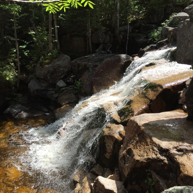
Beautiful scenery on the mostly flat first few milesThe falls on the way upThe view from ZeacliffLooking out over Carrigain and the Hancocks from Zeacliff. I did this same hike in November 2014 and this was all covered in snow!!The summit of ZealandMore of the falls on the way downThe Zealand Falls HutOne of the last little lady slippers of the season all by itself out on the trail
Interestingly, the Zealand Recreation Area you see off of 302 before the trailhead which is up the road a bit is where a small town used to be. Zealand was a town set up by J.E. Henry from Lincoln that had a boarding house, school, and a dozen homes. John Henry was into logging, and once they clearcut the entire wilderness in that area, they picked up and headed back to Lincoln leaving behind the town. The buildings all burned down between 1886 and the turn of the century, and the town faded into the past. There were many abandoned and now almost forgotten ‘company towns’ built for the logging industry in New Hampshire. Anyway, it was really cool leaving this hike and instead of just driving by the Mt. Washington Hotel, turning down the drive to our room!
Before the automobile, there were many grand hotels and boarding houses in the White Mountains, called the Great North Woods back then, where people from the cities in Massachusetts would stay for a month or two in the summer for some fresh air and recreation. The Mt. Washington wasn’t open in the winter until 2000. They would arrive by trains and ‘tallyhos’ which were horse drawn carriages. It took so long to get anywhere, you would stay longer. The Mt. Washington Hotel broke ground in 1900 and opened for guests in 1902. It was built by Joseph Stickney, who also owned the Mt. Pleasant Hotel (which is now where the Lodges at Bretton Woods are) across the street.
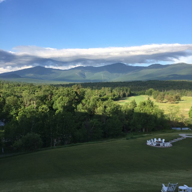
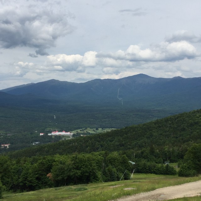
It is breathtaking, the largest wooden structure in New England, all white exterior with that bright popping red roof against the most beautiful backdrop- the Presidential Mountain Range. I have driven by the hotel many times in my hiking adventures, and looked down upon it from many peaks in the area. Last week was the first time I actually stayed there, and honestly I could have moved in. We stayed Wednesday night and Thursday night, and it was really great being there midweek. It was a lot less crowded from what I have heard. There was rain on Wednesday, but Thursday and Friday were gorgeous. Wednesday night we sat out on the veranda overlooking our beloved mountains. They sat tucked under a blanket of clouds until the sun set and the alpine glow set in. We went to dinner that night at Stickney’s, a restaurant in the lower level of the hotel that used to be the men’s billiard room back in the day. After, we had a couple drinks in The Cave, a space that was originally squash courts that became a speakeasy during Prohibition years. They drank from tea cups and had a view out the window to the driveway to see if any officials were coming up.
The beautiful mountains under the clouds
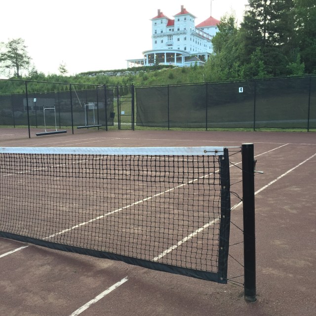
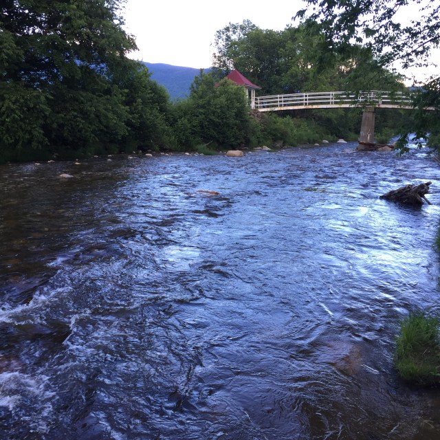
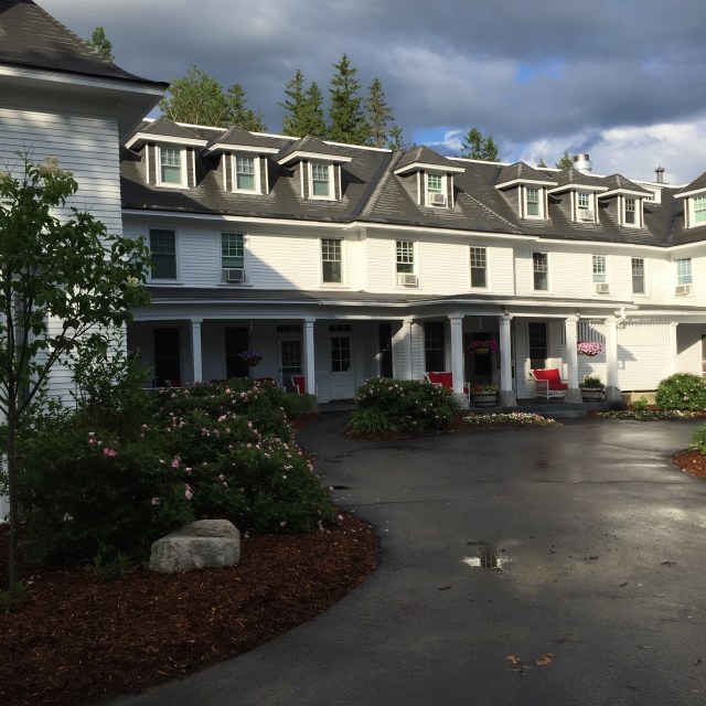
Red clay tennis courts, new from when the conference center/spa addition took up space where the old courts were.The Ammonoosuc RiverThe Bretton Arms Inn on the propertyThe carriage house that is now the stables/equestrian centerThe alpine glow at around 8PM. From left to right, the peaks are Jefferson, Clay, Washington, Monroe, Franklin, and you can just see the slope of Eisenhower.Out on the roof of the newer section of the hotel which houses a conference center/spa
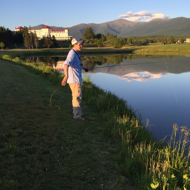
Thursday we hiked Zealand Mountain which was fantastic because it was only 15 minutes from the hotel. I will write up the hike in a separate post 🙂 Thursday night we did a little fly fishing in the trout pond out front before eating out on the veranda. After, we got a couple glasses of champagne, a book titled A Self Guided Historic Tour, and meandered around the hotel.
No trout caught unfortunately, we just caught some creek chubs
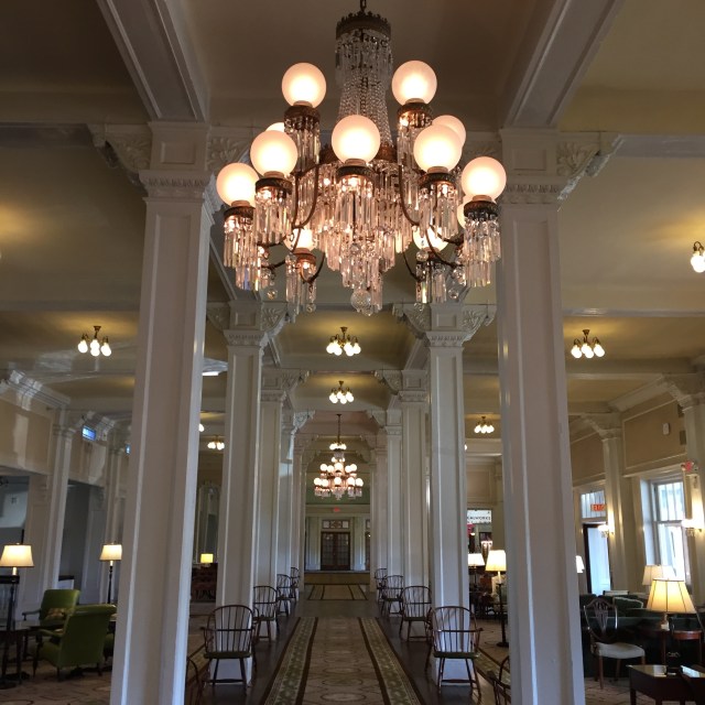
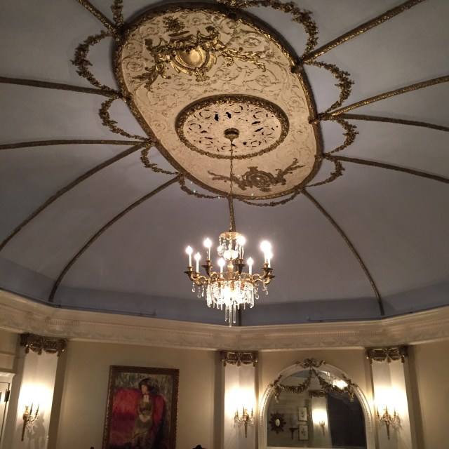
A place is always set for Carolyn Stickney, the wife of the original owner of the hotel. He died just a year after the great hotel had been built, and Carolyn remarried French nobility and used to summer at the hotel. The main dining room was built as a circle so that no table was inferior off in the corner, but the table just to the right of the entrance is always ready for the Princess.All the different place setting patterns over the yearsWhen Carolyn was summering at the hotel, she would watch all the dining guests make their way to the dining room and she would change if anyone was dressed more finely than her.The great hall aka the lobby of the hotel.The moose head above the grand fireplace in the lobbyOrnate ceiling and chandelier where Carolyn would have private dinners. Now it is used as a lounge area, nice for getting a drink before dinnerThe veranda above, and Stickney’s dining below.
Friday we had breakfast and took a last lap around before heading out on a couple more adventures. We went to the Gale River right by the trailhead to hike Galehead and I happily read my new book, Kaysen’s Cambridge, while my husband caught around 5 brook trouts. From there we went to the Bretton Woods ski area and took the free ski lift up to the Latitude 44 restaurant. Bretton Woods is a part of the Omni Mt. Washington Resort as is the hotel. The view from the restaurant looking across to the hotel and the mountains was beautiful. What a great ending to our trip.
It was an amazing place to stay. So many families and couples there were taking the cog railway up Mt. Washington, or driving up during their vacation. I heard excited children talking about their upcoming journey, parents telling them about the wind, or the pizza at the top! I have hiked all the Presidentials, and I will never forget hiking up Mt. Washington. A day in March when the world up there was still snow-covered and barren. The pizza wasn’t open, and there was no wind. It’s a beautiful place no doubt, but looking up from the plush cushions on whitewashed veranda wicker furniture to see mountains that you regard as familiar friends as opposed to awesome strangers is truly a gift.
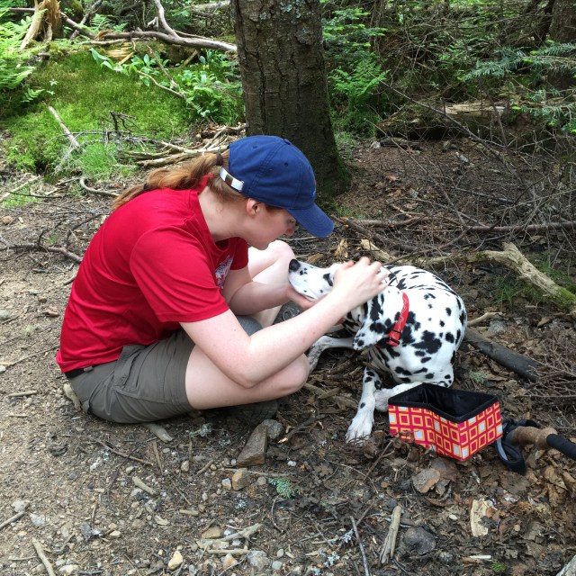
I am two peaks closer to finishing the New Hampshire 48 4000 footers! The original plan was to do Middle & South Carter and then Carter Dome but we had to turn back after South Carter. Descending from South Carter to the Zeta Pass before you head up the dome, we noticed Mizpah trying to lay down every time we stopped which is really weird for her, and then she actually limped holding up her left hind paw. We took a look at her paw and sure enough, she had a rip in her paw pad. We decided to head back, which did mean 4 miles of hiking down still. My little baby made it down ok, she sort of limped if there were rocks but walked ok on the nice packed dirt. Today she is doing better, she is tired but she did make it down the stairs ok and is eating/drinking.
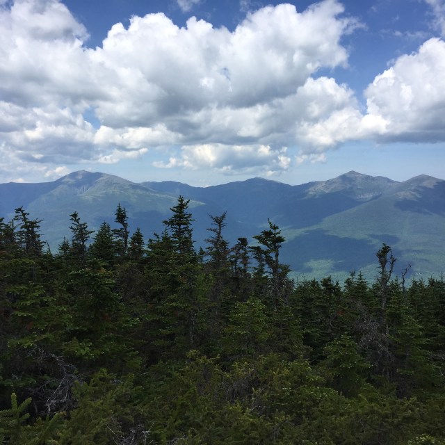
The two peaks we did don’t have views! I did take some pictures of the beautiful northern Presidentials from an outlook on a little summit before Middle Carter. I guess the really nice views are on Mt. Hight which is not technically a 4000 footer in between South Carter and Carter Dome. I have to go back up to do the dome so I will get to snag those views then!
This is the view of Lake Winnipesaukee from Mt. Major on Saturday!! We did the little Mt. Major with Jon’s parents on Saturday, it was such a beautiful day. Mt. Major was packed!Sunday was the ATV ride up the Mt. Washington auto road!! They shut down the auto road and only allow four wheelers up. The line of trucks and trailers was miles long in the morning.
Above is a picture of Camp Dodge, where AMC volunteers and employees can stay in the summer. We parked at the 19 Mile Brook Trailhead because thats where we were going to end, and walked up the road a bit to Camp Dodge and got on the Imp Trail towards Middle Carter there. It was cool to see Camp Dodge!
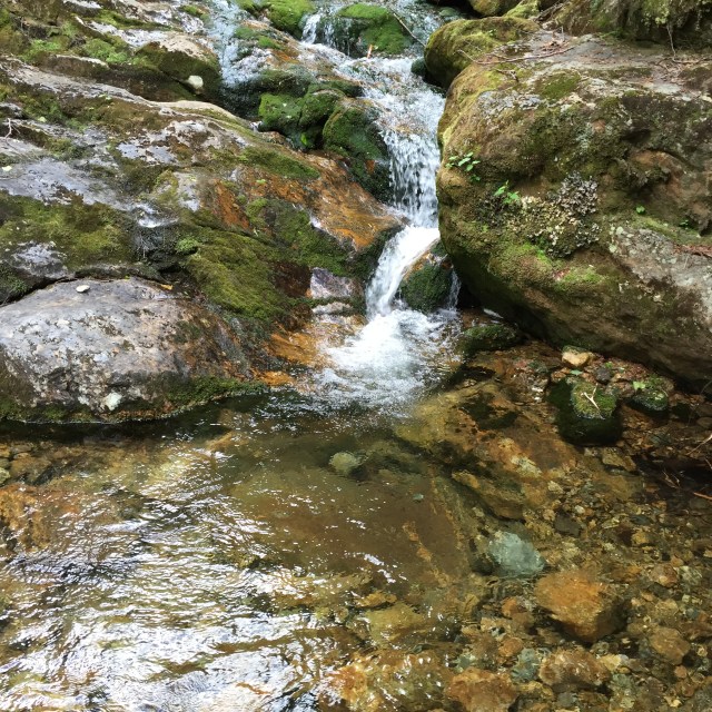
View of Mt. Washington, Mt. Jefferson, Mt. Adams, and Mt. Madison from an outlook by Middle CarterMizpah pre-pad tearMizpah post-pad tearLittle waterfall in the brookReally nice new bridge on 19 Mile Brook Trail.
We have some more hikes planned in the next couple months, so hopefully I will finish the 4000 footers this summer! Mizpah’s paw will heal, she just needs time. Its just so hard to watch my super athletic girl struggle and limp around. Friday was my last day of work until August 22 🙂 Let the summer adventures begin!!
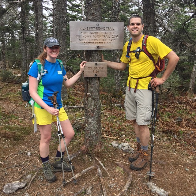
Well another Memorial Day weekend has come and gone. From what I have heard, Sunday was a miserable day in most of New England, but it was a beautiful day in northern New Hampshire on Mt. Cabot! Mt. Cabot is the farthest north of the 4000 footers up in Berlin NH. The trailhead is at one of the NH State Hatcheries, soooooo many trouts!!! We were already up at my inlaws’ house in NH, and from there it was still another 2.5 hours to drive. My sister, Brenda, came up to do this hike with me and my husband too! This was her 3rd 4000 footer, my 40th 4000 footer, and who knows what number it is for my husband haha, over 100?
So we went up Cabot via the Bunnel Notch Trail to the Kilkenny Ridge Trail. In total, the mileage was a little over 9 miles- took us about 6 hours. The trail was in great shape except for some mud which is normal for this time of year. It was a really warm day, many water breaks. There are some nice features along the way- a spot with some beautiful views, an old fire warden’s cabin that you can stay in, and a clearing close to the summit that has the remnants of an old fire tower. Many people stop at the tower clearing thinking that they have made it to the summit…but really you have to continue on and you will get to another clearing with a sign that says Mt. Cabot-4120′, and that still isn’t the summit, you have to go a little further to the true summit at 4170′. Two false summits. We saw many people at the fire tower clearing that never continued on to the actual summit.
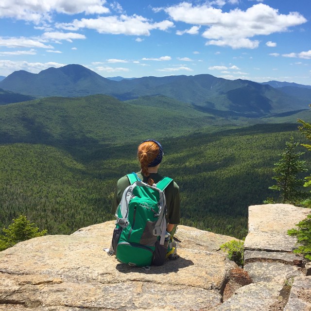
Green lush scenery has returned to the White MountainsMy sister and I love our LLBean Backpacks. Mine on the left is here and my sister’s on the right is here. My pack is smaller, more appropriate for a little day pack, and my sister’s is a little more appropriate for an overnight too.The girls at the view, Mizpah, me, and BrendaThe views were a little hazy on Sunday, but still beautiful. Everything is so green again!!!The old fire warden cabin near the summit of Mt. Cabot. The only cabin I have seen in the 4000 footers higher elevation. There are shelters, and then the AMC huts, and cabins at lower elevations, but this is a unique fixture.False summit #2 haha, me and JonStopping at the view for a little break on the way down. Best hiking dog. Love her.
On the way home, we stopped at Mountain Fire Pizza in Gorham NH for some dinner and a beer. Jon and I split the maple and bacon pizza, it was amazing. My sister got a pizza with chicken and artichoke on it, it looked great too! If you like thin crust brick oven pizza, then this is the place for you. Gorham is an interesting town, way up in the mountains. We went to Gorham last year for 4th of July fireworks when we were camping at Dolly Cop. ATVs are street legal in the town. Think about that for a second, you can drive 4-wheelers anywhere…to McDonald’s, to get some pizza, to pick up a friend, whatever. Pretty cool place. More pics from Memorial Day on Lake Winnepesaukee tomorrow!!
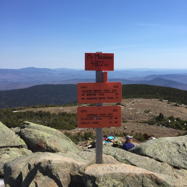
Sunday of this past weekend, my husband Jon, Mizpah, and I headed up to NH for a hike. Jon’s broken toe had healed just in time for our wedding, and we were ready to get back to hiking after almost 2 months away from our favorite mountains. We chose Mt. Moosilauke after reading through Saturday’s trip reports because Mt. Moosilauke had just some soft snow/ice on the Carriage Road trail where some of the mountains still require crampons. The Carriage Road trail is wide and gradual, it was a little over 10 miles and took us a little over 6 hours to do.
At the summit of Mt. Moosilauke, there are remains of the Prospect House built in 1860, later known as the Tip Top House, a hotel similar to the one on the summit of Mt. Washington. It burned down in 1942. The Carriage Road was built in 1870 to bring guests up to the summit.
Tip Top House, Moosilauke Breezy Point, NH
Breezy Point Road leads to the Carriage Road trailhead. Nathaniel Merrill built a farmhouse there in 1834, and converted the farmhouse in 1860 to serve as an inn called the Merrill Mountain Home. Slightly downhill from there, the larger Breezy Point House was built in 1877. It was destroyed by a fire in 1884, and then the Moosilauke Inn was built there in 1886. In 1915, the Merril Mountain burned down, and in 1953, the Moosilauke Inn burned down.
A smaller motel was built at the inn site which closed in 1981. Crazy history. The spot where the inn was is just a big field. I guess there was even a 9 hole golf course there around 1900. We did find a cellar hole around where the Merrill house could have been.
Then on our way out, we found this cellar hole further downhill from where the inn would have been. Could have been outbuildings from the original Breezy Point House.
Here are some more pictures from our hike. We did Moosilauke back in November too, and in this post, I discuss the link between Moosilauke and Dartmouth College.
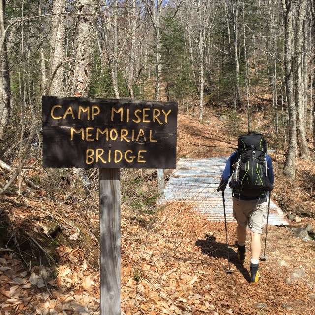
Built in the 1990s by the Dartmouth Outing Club, just beyond this bridge there was a shelter called Camp Misery in the 1930s. I believe the bridge is made of pieces of the shelter.Soft snow and ice on the trailMizpah and Jon on our way to the summit, South Peak in the background
Up on the summit, windy as usual!
View of Loon’s south peakMoosilauke’s summit is always windy, it is the first tall peak that gets wind from Vermont!
Beautiful birches on the trailMizpah relaxing when we got back to the car
So now I have done Moosilauke 3 times. Its great because there are so many different trails up and down it, I have never done it the same way twice. We are going to try to hike the next couple weekends and we have some big hiking plans for this summer. I still have 9 left to complete the 4000 footers in NH. Of course they are all tough, long, or far away hikes- save the craziest for last? I read this article this past week, and it really summed it all up for me. Where do you like to hike!? I love hearing other people’s hiking stories!!
I apologize for my blogging hiatus, but its been a crazy couple weeks since my Aiken SC trip. I got married this past weekend!!! We headed up to the Indian Head Resort in Lincoln, NH on Friday, and did our rehearsal there. Then we had our rehearsal dinner at one of our favorite restaurants, Truant’s Taverne. Now, some people think you have to choose- you are either a Truant’s fan, or a Woodstock Inn Station & Brewery fan. Woodstock is on the other side of the street, they brew their own beer, so delicious. I love both. I couldn’t decide if you made me. One benefit of Truant’s is that it’s closer to the ice cream place I guess. The people that own Truant’s also own White Mountain Bagel Co. which is where we got breakfast for Saturday morning at the hair salon. Their tomato basil bagel is so good. Ok I promise my wedding weekend wasn’t all about food…but we also got lunch on Friday at another place I love, Half Baked Fully Brewed….ok back to the wedding.
Rehearsal time with the traditional bow bouquet made from shower gifts 🙂 Wearing a Lilly Delia little white dress (sadly sold out)! Yes, the lake outside is still frozen on April 9th….New England
Indian Head Resort has many conventional hotel rooms, the ones with a view of the Shadow Lake, the Pemi River, and the mountains are the best. The resort also has two adorable houses for rent, so some of my bridesmaids were in one, and the groomsmen were in the other. Our rehearsal dinner was all about fun comfort foods- chicken fingers, mac n cheese, steak tips, and garlic whipped potatoes. There was also salad though, no worries, haha #eatclean. The varsity room upstairs at Truant’s has shuffleboard, arcades, pool tables, and a jukebox. It was such a fun night. We headed back to the hotel, grabbed drinks at the Thunderbird Lounge, and did some hot tubbing! Indian Head has an indoor heated pool/hot tub AND a heated outdoor pool/hot tub. The outdoor hot tub is huge, I want one.
Saturday, the mothers, bridesmaids, and myself headed off to the Daydreams Hair & Nail Studio for hair and makeup. The ladies at the salon were so sweet, they genuinely cared about what we wanted and we loved them! They made everyone’s hair and makeup dreams come true. Their makeup is a mineral based line, so it was great for my skin, and they had the wispie fake lashes which I love so much more than the blunt cut lashes.
We got back to Indian Head, put on our dresses, and then it was time for champagne and photos! Jon and I did a first look so we saw each other and did some pictures before the ceremony. It was so good for both of our nerves/emotions to do the first look. The ceremony was inside, and it was perfect. There were tears, laughs, and it feels like it was over so fast. We did some photos outside even though it was freezing, and then it was reception time. The food was amazing, our DJ was fabulous, and it was just awesome having so many friends and family members all together in one room!
Ceremony First Kiss!Reception First Dance!
My dress came from David’s Bridal, and my bridesmaids’s dresses were all navy/gold dresses from Lilly Pulitzer! My sister wore the navy beaded ‘Largo”, my friend Kayla wore the navy ‘Bentley’, and my three girlfriends from the barn actually did Rent the Runway for the navy ‘Valli’. My sister got her dress from the After Party sale, and the Bentley dress was really affordable on Amazon. The groomsmen were in gray tuxedos, navy ties, brown shoes, super classy looking bunch of guys.
This slideshow requires JavaScript.
After the wedding, we all hit up the hot tub one more time before heading to bed. Sunday many guests met up with for the breakfast buffet which includes lots of bacon and an omelette station….soooo good. Again, sorry for my food obsession.
Because I am in grad classes, we are not doing a honeymoon right away, but we do have some fun trips planned for the summer 🙂 I can’t wait to get the professional photos to relive the amazing weekend all over again. Both Jon and my families vacationed at Indian Head Resort growing up, often because camping trips got rained out at Fransted Campground, so it was extra special to be there, and with the mountains that we have hiked looking down over us….it was just a great weekend full of love and happiness. Hope you all had a lovely weekend!! Here’s one last pic of the beautiful sunset over the Franconia Notch.
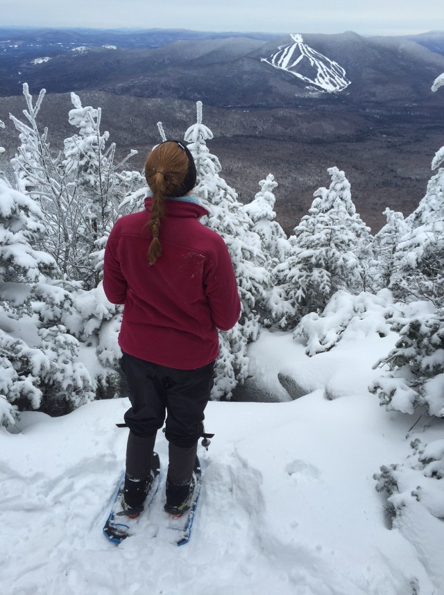
Oh man is this week kicking my butt! Between work, classes, homework, and wedding stuff, it feels like my free time is nonexistent! Today I finally took my wedding dress to get altered though, so that was a huge check off my list! Woo hoo accomplishment! This past weekend, we hiked Mount Jackson and Mount Pierce in NH. These are the southern most mountains in the Presidential Range and the trails start in the beautiful Crawford Notch area. Fun fact- Mount Jackson is actually named after Charles Jackson, the state geologist back in the 19th century NOT Andrew Jackson, our seventh president.
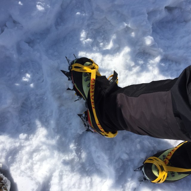
Jon, Mizpah, two friends, and myself set out on Sunday morning around 9 AM. Immediately we all put on our traction, three of us have crampons, and one of our friends just had microspikes. The trail was solid ice from melting snows. Wearing crampons is pretty serious business. You have to be careful of every step, making sure you don’t slice yourself or one of your hiking companions. Super scary with Mizpah running afoot. The day started a little gray, but over the course of the day, the sun came out and blue skies prevailed! We had pretty good views of the rest of the Presidentials. Mizpah had a great hike with the warmer temps and her claws were perfect in the soft ice. She will probably never hike the northern Presidentials (Washington, Jefferson, Adams, Madison) because of the rocky terrain, but the southern ones are ok. Her hut, the Mizpah Spring Hut, is on Pierce 🙂 Here are some pics from the hike!!!
Crawford Notch Depot- station for the Notch Train of the Conway Scenic Railroad which will resume service on June 14th!
Winter wonderland trails, like our very own NarniaView from Jackson- up on the left you can see Bretton Woods Ski Resort and thats the Mount Washington Hotel in the middle. The red roof is really easy to see up on the mountain, not so much in the photo!It’s really important to remember to bring food for yourself AND your dog. We bring a bag of Mizpah’s food for her to eat on the trail, and a water bowl!Yep, that ice is the trail, crazy!!For hiking on ice….here are my La Sportiva Nepal mountaineering boots, Grivel crampons, and EMS Gaiters (similar here) . Winter hiking is pretty awesome if you like to collect gear!The rest of the Presidential Range from Mt. Pierce- the ridge to Mt. Eisenhower looks so cool. Mt. Washington’s summit is in the clouds.
Frozen waterfalls on the Crawford Path down from PiercePicturesque little pup in her Ruffwear jacket and collarHad to take a quick snap on the way home of the Mount Washington Hotel and the Presi’s
My fiancé broke his toe the other day soooooo we might not be hiking again until April! Poor guy. I had already done these two mountains, but we were with a friend sort of new to hiking and wanted a short hike with nice views for him. This hike was about 6 1/2 hours. I still have 9 peaks left to finish the New Hampshire 4000 Footers. Goal is to finish by the end of this summer!
Hiking, horseback riding, trail running, swimming, biking…I love anything that gets me outside. What do you like to do to get outside? Do you have any outdoorsy goals for this spring/summer??
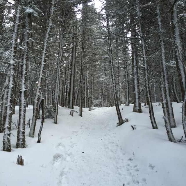
Yesterday I hiked North and Middle Tripyramid in the Sandwich Range Wilderness of New Hampshire’s White Mountains. They are both little guys, just over 4,100 feet. They are #38 and #39 out of the 48 4000 footers in New Hampshire for me!! We got started just after 10 AM up the Pine Bend Trail to the Mt. Tripyramid Trail. I was able to bareboot it on the trail until we started to climb. Then I had to throw my snow shoes on. Showshoeing for miles, climbing in elevation…..it is hard. This was an in and out hike-we went up over North over to Middle and then back again. There is a South Tripyramid that doesn’t count for “the list” even though it is over 4000 ft because there is not enough elevation dip and gain between Middle and South. If we weren’t pressed for daylight, we would have gone over- maybe when I do it again in the summer sometime.
The White Mountains is a Winter WonderlandPine Bend Brook and our baby girl, Mizpah
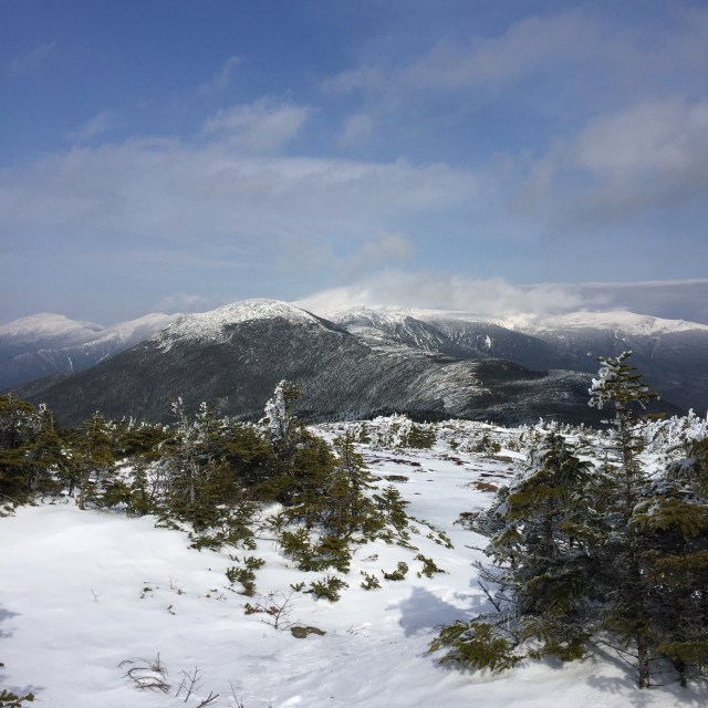
There are really no views from North Tripyramid. Every once and while, peaking out through the trees, I could see the Presidential Range, Mt. Washington’s recognizable white peak. You can see Mt. Carrigain over that way and the Signal Ridge too.
It was just a quick half hour over to the Middle Tripyramid, and there were some nice views from there. We could see the Waterville Valley Ski Area, Tenney Mountain Ski Area, and we could even see all the way to Killington Ski Resort in VT. We could see Lake Winnipesaukee and Gunstock Mountain Ski Resort too, but I just couldn’t get a decent picture. The Tripyramids are sort of central, you can see a lot of other familiar mountains from there.
Waterville Valley Ski Resort and Mt. Tecumseh, then way in the back is Mt. Moosilauke, and then back to the foreground, the OsceolasSummit of Middle Tripyramid- tiniest cairn, Mizpah, and then me and Jon’s his and hers La Sportive Nepal’s in snowshoes.Another view from Middle, the prominent peak on the left is Passaconaway and then next to that is Whiteface. All the way to the left in the distance is Mt. Chocurua
It was a hard hike, coming down off North Tripyramid I had to “buttslide” for a lot of it because it was too steep to actually walk down, you just slip and slide anyway. I could have put my crampons on my boots, but honestly crampons are scary and if you think you are going to misstep, they really shouldn’t be worn. You can slice your leg or your hiking companions by mistake with a crampon. My crampons are for climbing up sheets of ice only.
Mizpah came along yesterday, but chances are this will be her last long hike until the weather warms up again. She loves hiking, loves the journey, but girlfran just isn’t equipped for the weather up there. Her paws get cold and no matter what we try- different salves/waxes, many brands of booties- we just can’t find her any relief besides just sitting the hike out. Her little Ruffwear jacket keeps her body warm, but those paws….
Finishing the hike just before dark
So I am now down to single digits. Just 9 mountains left to struggle up 🙂 Then I will probably want to do them all in the winter…..or do the additional 4000 footers in Maine & Vermont…or just hike with my lovely fiancé Jon as he works toward the grid (all 48 in all 12 months). I hope you all had a great weekend, I will takin it easy today, nursing some sore muscles. I am thinking it might be time to do a winter hiking gear post…there’s a lot….if you like buying gear, def get into winter hiking ha!