Mt. Moosilauke: 1st 4K Hike Postbaby!

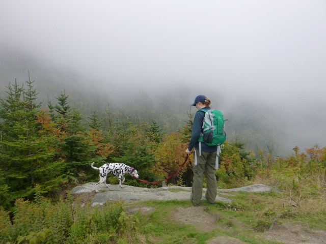
I am officially back into hiking!! We stopped exclusive pumping as Cabot passed 9 months and I was looking forward to getting back into the White Mountains. Over the past year, the Moosilauke Ravine Lodge got a huge facelift, and I have been excited to get over there to see it. This was my 4th time hiking Mt. Moosilauke, and yes I saw something on this hike that I never noticed before…..read on to find out more!

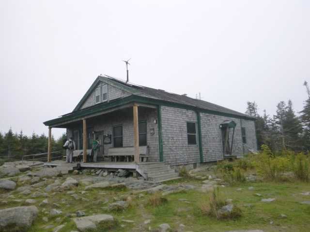
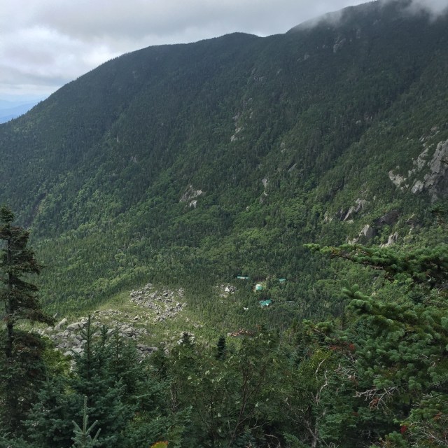
SO I will start with the lodge, which is actually a collection of buildings. There’s the main lodge which was renovated and then the bunkhouses, each standing in the name of the gifts for different classes.

IMG_3114
The new main lodge!
IMG_3115
Main Lodge
IMG_3126
Class of 1965 Bunkhouse
IMG_3055
Class of 1974 Bunkhouse
IMG_3054
Class of 1967 Bunkhouse
IMG_3100
Moosilauke Ravine Lodge from above!

They are still working on the access road to the lodge and culverts and such, but the new lodge looks great!

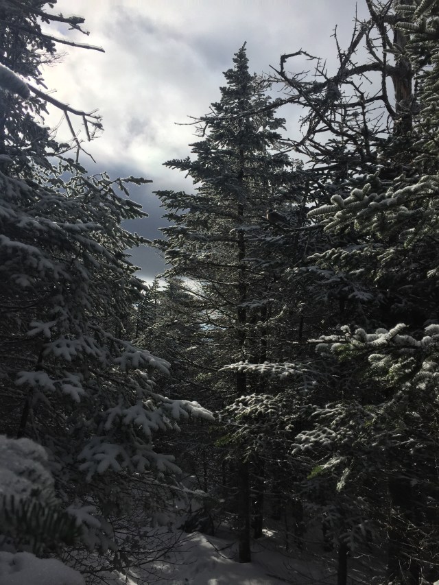
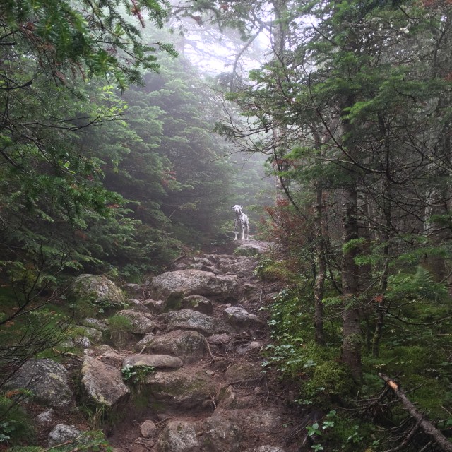
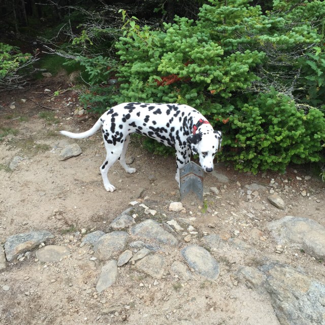
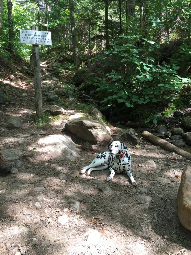
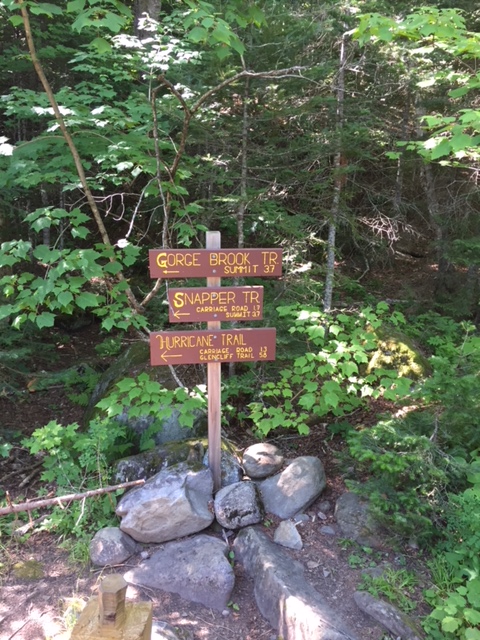
We took the Gorge Trail for this hike. Mt. Moosilauke is really a lovely hike. There is much Dartmouth Outing Club history on the trail up from the lodge. The trails are very well signed and taken care of thanks to the Dartmouth student trail crew.

IMG_3058
Information kiosk where we began!
IMG_3060
The cutest little trail dog, Mizpah, heading out!
IMG_3061
Trail crews sometimes leave signs commemorating their work
IMG_3082
Up on the summit!
IMG_3077
Our hiking group posing with the button on the summit. A picture with the geological marker is a must for my husband!
IMG_3088
Beautiful mountain views all the way around on the summit

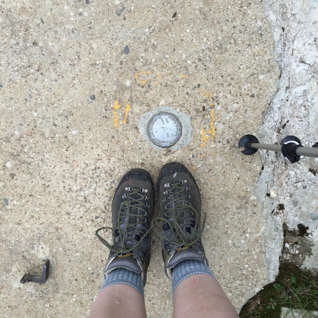
On the summit, remnants of the stone foundation for the old summit hotel can be seen. It was originally built in 1860 and called The Prospect House but the name was changed to the Tip-Top House. It burned down in 1942.

IMG_3090
Stone Foundation left behind from the Tip-Top House

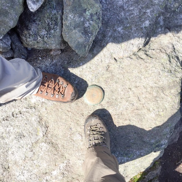
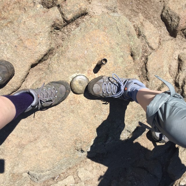
Now! To the thing that I never noticed on the previous three hikes of Mt. Moosilauke! There is a concrete foundation visible from the summit that was from a shelter that was removed in 1978.

IMG_3097
Concrete foundation for the shelter removed in 1978.

I almost fell over when I saw that from the summit, and then I actually had a hard time finding it along the trail. I guess they tried to use a jackhammer to remove the foundation but it was just too much work.

IMG_3101
Finished the hike!
IMG_3112
Tired little Mizpah eating her lunch back at the car

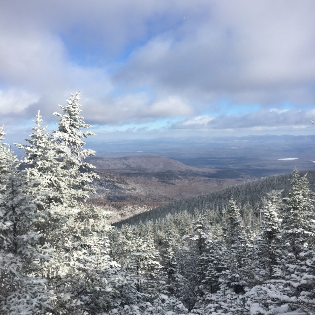
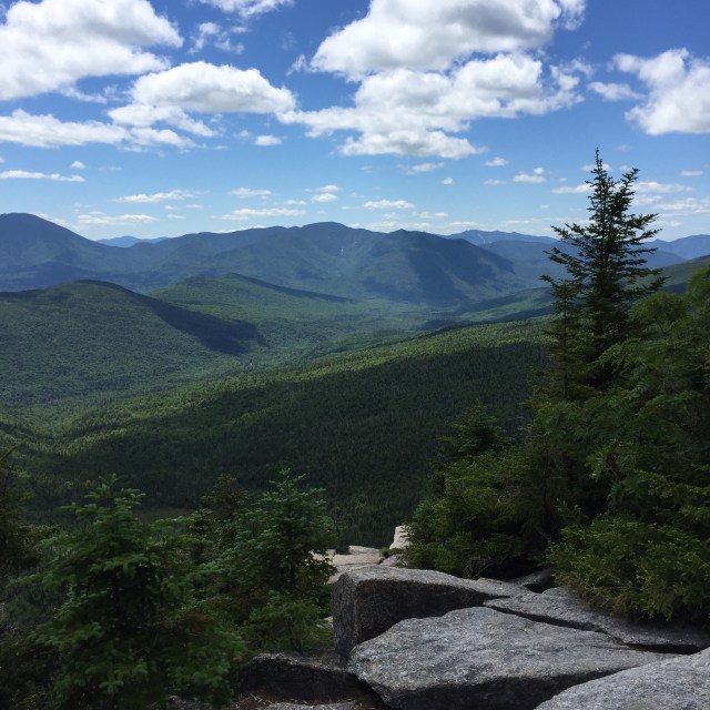
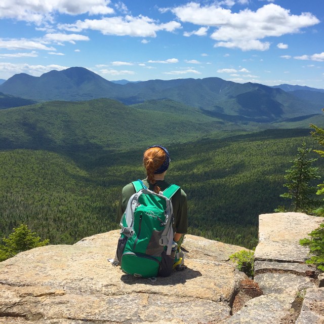
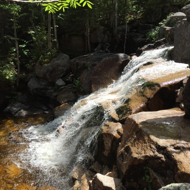
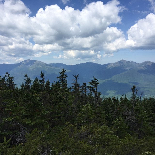
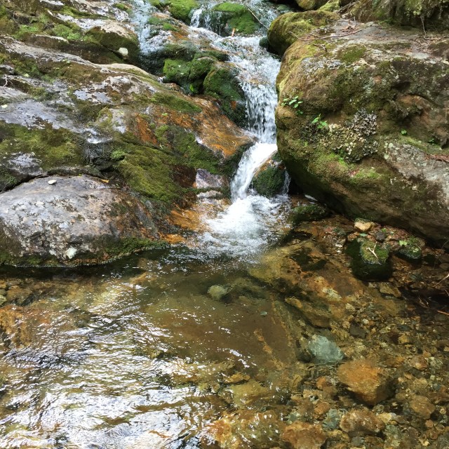
We had great weather for this hike. The forecast actually said “sunny and delightful” for Warren NH. Typically the summit is very windy because its the first tall mountain from Vermont. It was a lovely first hike back after over a year of missing hiking. Coming down Gorge Brook, a thru hiker passed us. We wondered where he was heading. Sure enough he came back and said, “This isn’t the AT huh?” We laughed. Good sense of humor probably helps doing the AT. He meant to go down the Beaver Brook Trail and probably planned to stay at that shelter. The Beaver Brook Trail from what I have heard is a hard one.

Anyways, here are my other Mt. Moosilauke posts! You can see the old lodge in one of them.

Mt. Moosilauke Hike on the Carriage Road

Dartmouth Outing Club & Mt. Moosilauke (has a pic of the old lodge)

Signature 2

Birthday Hike up Mt. Cabot

As part of our MLK weekend away in Jackson NH, we hiked up Mt Cabot on my birthday! Mt. Cabot is the 4000 footer that is farthest north, so having the opportunity to start the drive a couple hours closer was a huge reason to do that one. The hike itself is a gradual easier hike; the hardest thing about hiking Cabot is getting there.

We wore snowshoes for the entire hike, all 9 miles of it. The trail was so nice and tracked out, it would have been a shame to ruin it with post holes. The trail begins at the trout hatchery in Berlin on York Pond Road, which was nicely maintained for this time of year. You start out on the York Pond Trail, and then turn onto the Bunnell Notch Trail, and then finally the Kilkenny Ridge Trail to the summit. In the interest of time, we did an in and out hike, you can do a loop from the summit down over the bulge and horn from the Kilkenny Ridge Trail to the Unknown Pond Trail, but its a longer hike.

img_8760
Mountain Views
img_8758
Another gorgeous view!

Some features as you get up near the summit include an outlook with a beautiful view, a cabin, a false summit where a fire tower used to be, and then finally the wooded summit which is past a Mt. Cabot sign which again looks like the summit. The fire warden cabin is available for public use. It’s free, first come first serve, and it sleeps 8. There used to be a wood stove in it that has been removed, and there is a picnic table inside. They keep a drum outside that collects rainwater in the summer. It’s a very primitive cabin that I believe is still maintained by the Jefferson boy scouts. Not a bad place to have a snack away from the wind, but I would only stay in there overnight if it was an emergency! The first firetower was built up there in 1911, it was rebuilt in 1924, and then taken down in 1965. It was a cold hike, the wind chill was down between -9 and -18. The sun was out though, and I had my warmest gear, so we made a great day out of it. On the way up to Jackson we actually stopped at IME in North Conway and I purchased some Black Diamond mercury mitts for myself and honestly, it made my hike so much more pleasant. They were $109.95 and worth every cent.

img_8756
The Cabot Cabin
img_8764
Had to take a pic of this fat little gray jay that followed us from the cabin to the summit!

Mt. Cabot was my 14th winter peak, and it really is one of my favorite mountains. It was a great way to spend my birthday. On the way back to the Eagle Mountain House we grabbed sandwiches at my favorite deli, J-Town. Then that night we did dinner at The Red Fox and drinks at Wildcat Tavern. All my favorites 🙂

Other posts from our MLK weekend trip up to Jackson:

Winter Weekend at The Eagle Mountain House, Jackson NH

Mountain Town Charm- Jackson, NH

Signature 2

Snowy hike up Mt. Liberty & Mt. Flume

It may not technically be winter, but it seems no one has discussed this with the White Mountains of New Hampshire. They are already quite white! This past weekend we headed up the Liberty Spring Trail to Mt. Liberty and then over to Mt. Flume and back. You can do a loop going up the Flume Slide Trail to Flume over to Liberty and then down the Liberty Spring Trail but at this time of year, the slide is a slippery treacherous mess.

We left Mizpah at home because it was a seven hour hike, 10 miles, which is just too much for Mizpah in the cold and snow. On the ridge between the peaks, we used snowshoes, and then descending from Mt. Liberty, we wore microspikes. It was beautiful up there- the snow and the rime ice were so pretty. It almost looks like another planet up there.

img_7823
Rime ice on the rocks in the cloud on Mt. Liberty
img_7833
Those are trees on the slope there, trees frozen in ice from precipitation and freezing fog.
img_7837
On top of Mt. Flume, the clouds finally parted!
img_7847
The evergreens are magical covered in snow
img_7865
Up on Mt. Liberty the second time looking back at Mt. Flume
img_7871
Looking out to Mt. Lincoln from Mt. Liberty. This might be my favorite shot of the day….all the snow covered evergreens.

The last time I did Liberty and Flume was September of 2014 and it was wet and foggy. I was so happy to see some views this time. Liberty and Flume are a part of the Franconia Ridge which is probably some of the most picturesque mountains in the Whites.

Signature 2

Black Friday Mt. Tecumseh Hike

A tradition that my husband and I started a couple years back was going hiking on Black Friday after Thanksgiving instead of going shopping. Last year REI even did a campaign for heading outdoors on Black Friday called #optoutside. They gave all of their employees a paid day off and the stores closed to all them to go out and enjoy nature with families and friends instead of in crazy lines at stores.

Sadly this year Jon had to work, but Mizpah and I hit the trails and did a little girls hike. This was my third time doing Mt. Tecumseh. It is a great 4000 footer because its so short, just took me three hours. We had to be back in the afternoon to go out with Jon’s family that night so I had to pick a quick mountain!

Usually the views from Mt. Tecumseh are lovely. Here are the views from an outlook over one of the Waterville Valley Ski trails and a view from the summit. These pics are from September 2015.

img_0957
View from outlook on Mt. Tecumseh trail, not sure which trail this is at Waterville Valley?
img_0977
View from the summit. The summit for this one is small, just a cairn up there and some views!

The weather on Friday was drastically different. Driving up, it was rainy and sleety, and just past exit 19 on 93 there was snow on the ground and trees. The hike was literally in a foggy cloud the whole way. It wasn’t raining or snowing but my jacket and pack were soaked just because the air was soggy and wet. The snow on the trails was beautiful. It was definitely fresh because literally only one person had been on the trails that morning on the snow. There were no views, it’s just white. Honestly it was almost a little disorienting.

img_7694
No views at the outlook on the ski trail, huge difference huh?
img_7701
Snowy white summit!

I wore my waterproof Marmot pants which are dead now….I put another hole in them slipping down a snow covered rock. My Marmot shell jacket is still awesomely waterproof and my pack held up with the moisture. Mizpah had her Ruffwear jacket on too which was good and kept her dry and warm!

img_7698
Its a winter wonderland in the White Mountains!
img_7695
One of the best hiking dogs you will ever meet ❤

Noone would say the conditions were optimal, but it was still a nice hike. I bare-booted the whole way up, and then threw my microspikes on for the trek down so I could go a little faster. The only thing I purchased during the holiday sales was actually a pair of Tory Burch boots. They were on sale from almost $500 to $208! I have been needing a new pair of black boots and I think these will fit the bill nicely 🙂 I know I am a little late, but I do hope everyone had a nice Thanksgiving holiday with friends and family! Anyone snag anything good during the sales??

Signature 2

October Hike up Galehead Mtn

Last Sunday, despite some cloudy conditions, we hiked up Galehead Mountain in the White Mountains. This is a mountain that I have already done in July last year, but my sister and a friend needed it for their 48. Our friend brought his dog, Marshall, and this was his first hike! Its a great hike- nothing too technical, just 6 hours. There is a hut on the way to the summit with some views, the Galehead Hut, and the summit itself is in the trees. The Galehead Hut is a nice one because its just one building- so the lodge, bunks, and bathrooms are all together. Some of the huts are multiple buildings so you have to find the one with the bathrooms in it.

The trail we took in an out was called the Gale River Trail  and then Garfield Ridge Trail to the hut, and finally the Frost Trail to the summit. All together round trip the distance is about 10 miles.

p1040180
Foliage starting to turn
img_7051
Foliage on the left!

img_7050

p1040219
Mountain hat from Harding Lane here 🙂

p1040194

p1040232
Leaving the hut to head up the Frost Trail to the summit
p1040228
Four people, two dogs at the summit cairn- 16 legs in all 🙂
img_7056
Sisters ❤ LLBean packs can be found here and here.

Its always fun to hike with a group because the constant conversation makes the hike fly by. After we hiked we hit up Truant’s Tavern in Woodstock NH for some dinner. It was a cool & damp day, so having some chili really warmed me up. The trail was actually dry despite the conditions and the crossings were very manageable. The dogs were great, it was fun to see Mizpah hike with another pup.

p1040250

Signature 2

Mt. Isolation Hike

This past weekend we finally got some fall weather! My husband, Jon, and I celebrated the fantastic weather by heading up north to hike Mt. Isolation. This particular peak is just over 4000 feet at 4003 feet and is technically in the Presidential Range. I never considered it a part of the Presidential Range because it isn’t named after a president, but it is. Its also in the Dry River Wilderness, which means a couple things- any existing structures will be removed when maintenance is needed and not replaced, no bridges, some planks that are logs not lumber, signs aren’t painted, and not many blazes between signs. There was a shelter built on the trail that has been removed. There are some primitive camp sites up there though. Most people are not huge fans of the hike because it is very long, the river crossings can be treacherous, and the trail is usually muddy and gross. Right now, New Hampshire is in a drought though! So I guess the only good thing that can come from the drought is the pleasant trail I got to hike on?

We took the Rocky Branch Trail to the Isolation Trail to Davis Path up to the summit. That made a 14.5 mi, 9 hour trip. There is a shorter route in both time and mileage but it is harder up and down the Glen Boulder Trail. You gain elevation, lose it, and then gain it again. The crossings over the Rocky Branch were beautiful. Some foliage is starting to turn, mostly the leaves are green and yellow, very few red leaves.

img_6975

img_6974
Rocky Branch. These crossings can be tough in the spring and winter depending on the amount of precip the mountains get!
img_6969
My pack and fleece are both from LLBean
img_6972
The peak just to the left of center is Mt. Monroe. That ravine you can see there is Oak’s Gulf. Mt. Washington is hidden in the cloud in the right center.
img_6973
Our boots are La Sportiva Pamirs. These are the boots I would grab if I had to take one pair of shoes for a zombie apocalypse. 
img_6968
In this pic you can kinda tell how windy it was, it was crazy up there.

img_6967

Mizpah stayed home for this hike because it was just soo long. Now I only have 4 peaks left to have hiked all 48 4000 footers in NH. I need to do the three Bonds and Owls Head. We want to do both of those hikes as overnights, so I probably won’t finish until next summer. It was cold up there, and the winds were gusting up to ~50 mph. The views were so worth is though. I was just a little bummed that Mt. Washington was in a cloud. From Mt. Isolation you can take trails over to Mt. Washington, Mt. Monroe, and to the Mizpah Spring Hut just below Mt. Pierce. I am looking forward to more fall hiking, bring on the leaf peepers!

Signature 2

Carter Dome hike to finish the Carter’s!

A while back we hiked Middle & South Carter in the beautiful White Mountains of New Hampshire but couldn’t do Carter Dome because my pup hurt her little paw pads. This past weekend we took a break from house stuff to finish the Carters. I now only have five mountains left to finish the 48 4000 footers in the Whites!! Woo! I have to hike the Bonds which is 3 peaks, Isolation, and Owls Head to finish up.

IMG_6335
Mizpah playing in the 19 Mile Brook
IMG_6337
The main building at the Carter Notch Hut
IMG_6336
Carter Pond…check out that cloud creeping up
IMG_6339
Another Carter Pond shot
IMG_6341
Looking down into the notch at the Carter Notch Hut. Those rocks down there look small, but they are the size of buildings!
IMG_6342
Looking out into the Wild River Wilderness from a view before the summit
IMG_6344
Mizpah ascending into the cloud

We went up 19 Mile Brook Trail to the Carter-Moriah Trail which has some steep parts to the summit. The Carter Notch Hut is off the Carter-Moriah Trail. This particular hut has different buildings for the bathroom, bunks, and dining area whereas a hut like the Mizpah Spring Hut has everything in just one building. The summit has the remnants of a tower which is cool even though it doesn’t have great views. We were in a cloud the day I hiked though so there were no views no matter what.

IMG_6345
We thought this was a geocache in the rocks of this cairn near the summit, but the note inside was actually a very sweet memorial tribute 🙂
IMG_6346
My trusty La Sportiva Pamirs….these are my zombie apocalypse footwear….yes we have discussed what footwear we would grab for a zombie apocalypse.
IMG_6354
Summit!
IMG_6367
In a cloud on the summit!
IMG_6366
Mizpah investigating one of the old anchors for the tower that is no longer up there

We took the Carter Dome Trail back down to the 19 Mile Brook Trail which is a little longer, but not as steep. I would MUCH rather go up something steep and come down something more gradual for my knees’s sake. It’s better for Mizpah’s joints too!!

IMG_6374
Yep, we handfeed Mizpah her food out on the trail. She never eats breakfast before we leave for a hike, so anytime we take a break, we offer her food to keep up her energy!
IMG_6385
Mizpah lounging trailside
IMG_6380
Love the scenery on the 19 Mile Brook Trail!

It was a really great hike to do after taking a little time off. We even ran into one of my favorite instagrammers out on the trail- @munjoyboy. He was coming down Carter-Moriah as we were heading up. He has AMAZING photos of many of my favorite places.

Signature 2

Southernmost Presidentials Hike

Last week, I got to do a midweek hike with my sister who is just starting out doing the 4,000 footers in NH. We did Mt. Jackson and Mt. Pierce, which are the most southern 4,000 footers in the Presidential Range. This was actually my third time hiking these two, but first time in the summer!

We took the Webster-Jackson Trail from Rt. 302 to Mt. Jackson, and then the Webster Cliff Trail over to Mt. Pierce, and finally the Crawford Path back down to Rt. 302. It was my first 4000 footer hike without my husband, and so I felt a little pressure to make sure we were on the correct trails, going the right way and so on. Mt. Webster is up there too, named after Daniel Webster, but it’s not a 4000 footer so we had to make sure we avoided that trail.

Mt. Jackson is actually not named after Andrew Jackson, our 7th president. It is named after Charles Jackson who was a physician and the state’s geologist! On the way to Mt. Pierce, named for Franklin Pierce, is the Appalachian Mountain Club (AMC) run Mizpah Spring Hut. It was a really nice one. It made me miss my pup, Mizpah, but her paw pads were still healing.

IMG_5889
View down from Mt. Jackson. You can just barely see the Mt. Washington Hotel down there! Just to the right of center with that red roof!
IMG_5892
Sisters at the summit!
IMG_5890
The rest of the Presidentials from Jackson, you can see Washington perfectly high up on the right!
IMG_5896
Mizpah Spring Hut, just below the summit of Mt. Pierce
IMG_5898
The Mizpah bell in the hut, reminded me of my pup!
IMG_5900
Matching Merrell boots up on top of Mt. Pierce! Mine on the left are just really old haha. Mt. Pierce was originally named Mt. Clinton after DeWitt Clinton, a governor of NH.
IMG_5904
Just starting out on the Crawford Path, beautiful views of the Presis
IMG_5905
Someone on the trail got really excited about my mountain hat, said he was friends with one of the Harding Lane guys! We probably could have had a nice convo if I wasn’t so awkward and unable to speak more than “hi, how are you, have a nice hike” haha

IMG_5906

The Crawford family….you really can’t discuss the history of the White Mountains without talking about a few families, and the Crawford’s are definitely one. Abel and Ethan were father and son. They cleared a path up from Rt 302 to Mt. Pierce (Clinton then) over to Mt. Washington and guided hikers up. Abel at 75 years old in 1840 ascended this trail to Mt. Washington on horseback!! The path is just over 8 miles and goes over Mt. Eisenhower, Mt. Monroe, past the Lake in the Clouds, and ends up at Mt. Washington’s summit.

It was a really hot day which meant drinking lots of water. Having the hut was nice to fill up and not have to worry about running out of water. When we finished our hike, we headed to the Woodstock Inn Station & Brewery for a beer and some food. So delicious. I got the chicken salad melt which is an open faced sandwich on their spent grain bread, and my sister got a bison bacon bbq burger. We both got their summer beer which is deliciously light and refreshing. It was just a great day with my sister, so thankful to be able to hike with her!

Signature 2

Zealand Mountain Hike June 30th

We stayed at the Mt. Washington Hotel last week for a few days, and of course had to do a hike while we were there. The trailhead for Zealand is just 15 or so minutes from the Mt. Washington Hotel. Its a longer hike distance wise, but only took us 6:30 to do! The Zealand Falls Hut is on the way, and past it you can see the falls. The falls are beautiful. Zeacliff has beautiful views on the way to Zealand. Zealand’s summit doesn’t have views, it is tree covered.

IMG_5689
Beautiful scenery on the mostly flat first few miles
IMG_5690
The falls on the way up
IMG_5696
The view from Zeacliff
IMG_5744
Looking out over Carrigain and the Hancocks from Zeacliff. I did this same hike in November 2014 and this was all covered in snow!!
IMG_5716
The summit of Zealand
IMG_5718
More of the falls on the way down
IMG_5719
The Zealand Falls Hut
IMG_5722
One of the last little lady slippers of the season all by itself out on the trail

Interestingly, the Zealand Recreation Area you see off of 302 before the trailhead which is up the road a bit is where a small town used to be. Zealand was a town set up by J.E. Henry from Lincoln that had a boarding house, school, and a dozen homes. John Henry was into logging, and once they clearcut the entire wilderness in that area, they picked up and headed back to Lincoln leaving behind the town. The buildings all burned down between 1886 and the turn of the century, and the town faded into the past. There were many abandoned and now almost forgotten ‘company towns’ built for the logging industry in New Hampshire. Anyway, it was really cool leaving this hike and instead of just driving by the Mt. Washington Hotel, turning down the drive to our room!

Signature 2

Middle & South Carter Hike

I am two peaks closer to finishing the New Hampshire 48 4000 footers! The original plan was to do Middle & South Carter and then Carter Dome but we had to turn back after South Carter. Descending from South Carter to the Zeta Pass before you head up the dome, we noticed Mizpah trying to lay down every time we stopped which is really weird for her, and then she actually limped holding up her left hind paw. We took a look at her paw and sure enough, she had a rip in her paw pad. We decided to head back, which did mean 4 miles of hiking down still. My little baby made it down ok, she sort of limped if there were rocks but walked ok on the nice packed dirt. Today she is doing better, she is tired but she did make it down the stairs ok and is eating/drinking.

The two peaks we did don’t have views! I did take some pictures of the beautiful northern Presidentials from an outlook on a little summit before Middle Carter. I guess the really nice views are on Mt. Hight which is not technically a 4000 footer in between South Carter and Carter Dome. I have to go back up to do the dome so I will get to snag those views then!

IMG_5584
This is the view of Lake Winnipesaukee from Mt. Major on Saturday!! We did the little Mt. Major with Jon’s parents on Saturday, it was such a beautiful day. Mt. Major was packed!
IMG_5601
Sunday was the ATV ride up the Mt. Washington auto road!! They shut down the auto road and only allow four wheelers up. The line of trucks and trailers was miles long in the morning.

IMG_5602

Above is a picture of Camp Dodge, where AMC volunteers and employees can stay in the summer. We parked at the 19 Mile Brook Trailhead because thats where we were going to end, and walked up the road a bit to Camp Dodge and got on the Imp Trail towards Middle Carter there. It was cool to see Camp Dodge!

IMG_5606
View of Mt. Washington, Mt. Jefferson, Mt. Adams, and Mt. Madison from an outlook by Middle Carter
IMG_5612
Mizpah pre-pad tear
IMG_5629
Mizpah post-pad tear
IMG_5633
Little waterfall in the brook
IMG_5635
Really nice new bridge on 19 Mile Brook Trail.

We have some more hikes planned in the next couple months, so hopefully I will finish the  4000 footers this summer! Mizpah’s paw will heal, she just needs time. Its just so hard to watch my super athletic girl struggle and limp around. Friday was my last day of work until August 22 🙂 Let the summer adventures begin!!

Signature 2