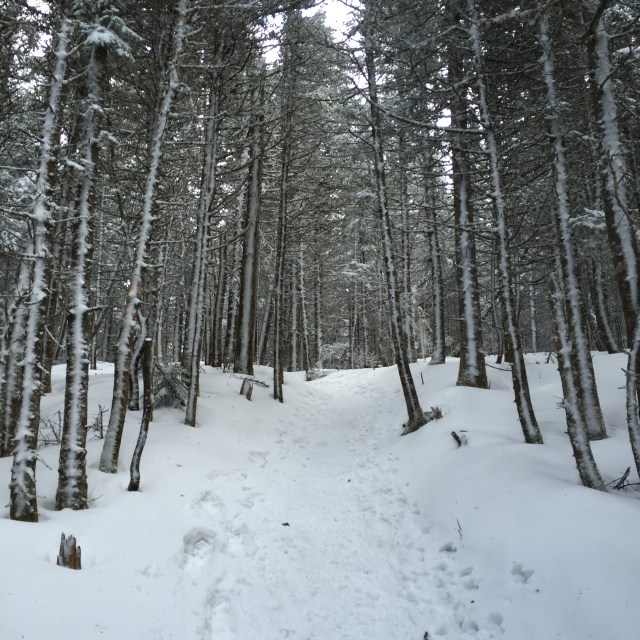
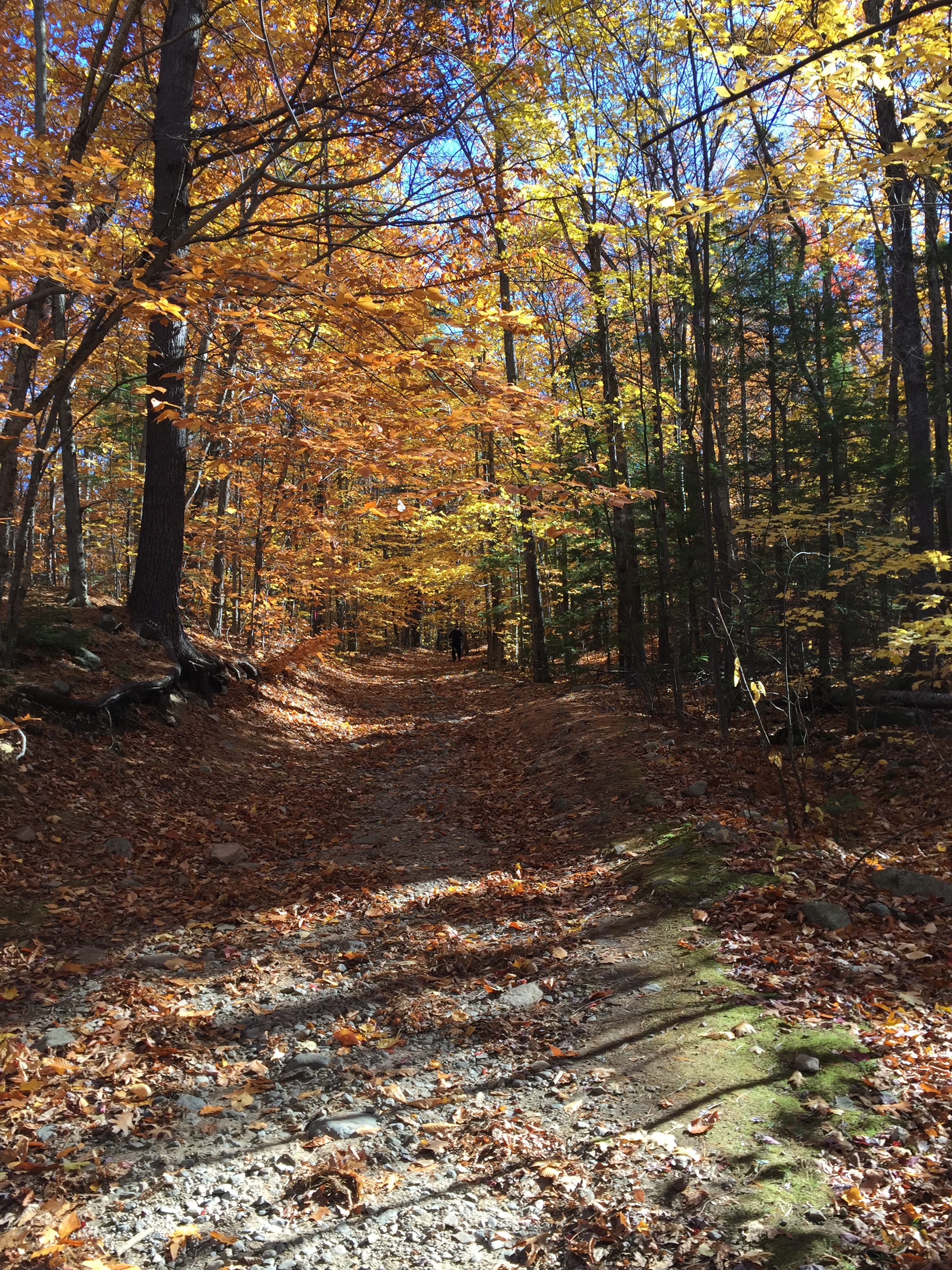
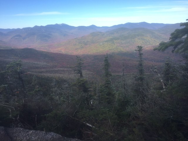
Oh man is this week kicking my butt! Between work, classes, homework, and wedding stuff, it feels like my free time is nonexistent! Today I finally took my wedding dress to get altered though, so that was a huge check off my list! Woo hoo accomplishment! This past weekend, we hiked Mount Jackson and Mount Pierce in NH. These are the southern most mountains in the Presidential Range and the trails start in the beautiful Crawford Notch area. Fun fact- Mount Jackson is actually named after Charles Jackson, the state geologist back in the 19th century NOT Andrew Jackson, our seventh president.
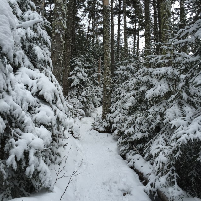
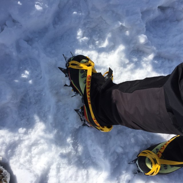
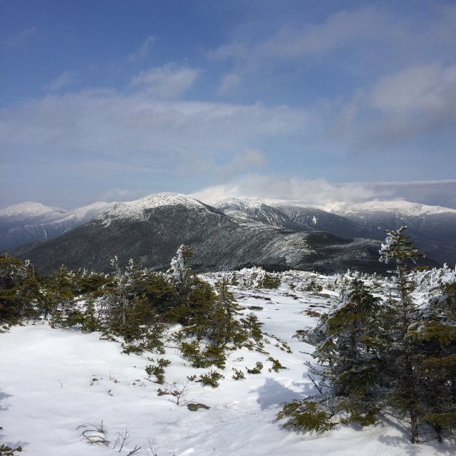
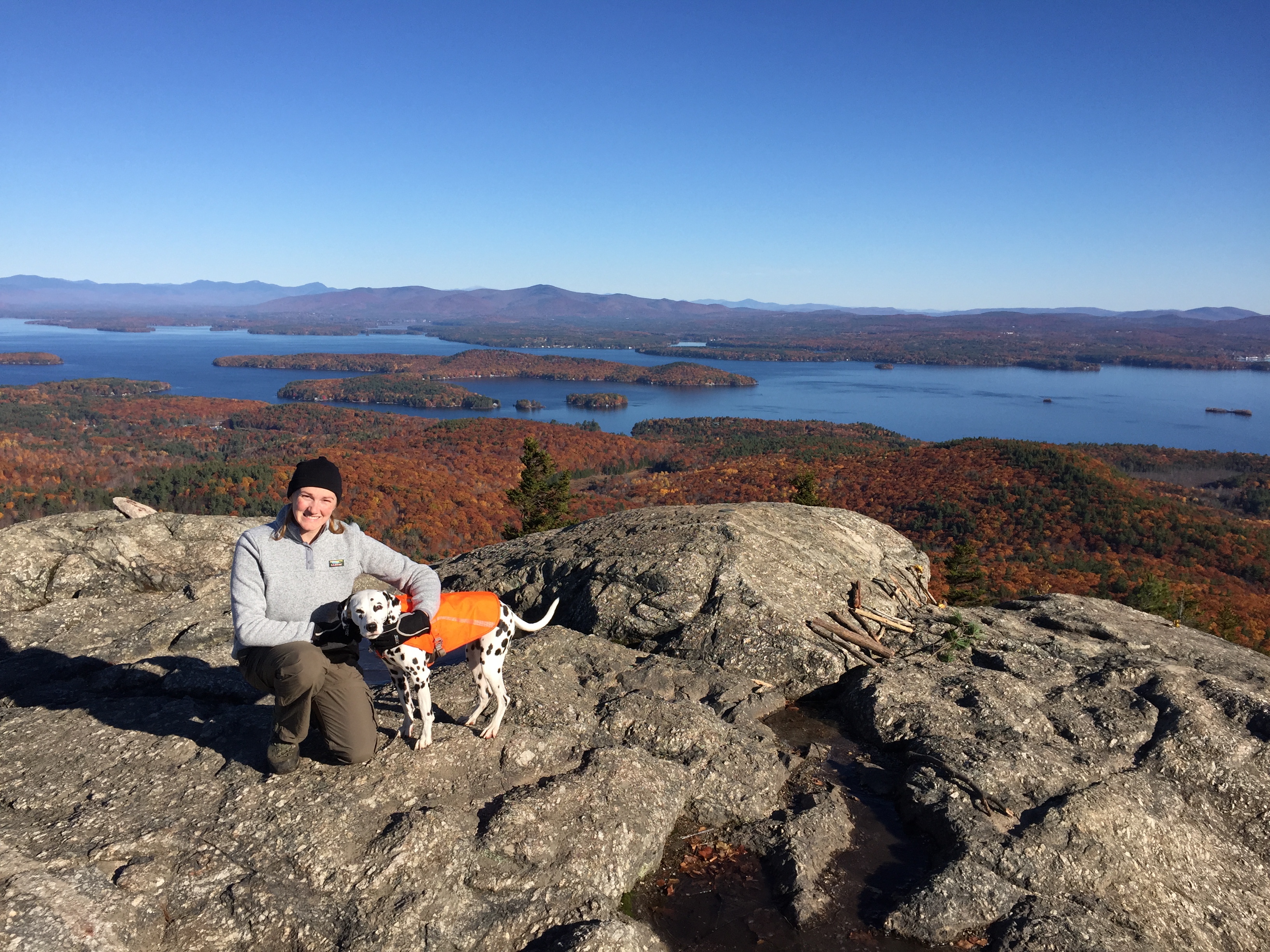
Jon, Mizpah, two friends, and myself set out on Sunday morning around 9 AM. Immediately we all put on our traction, three of us have crampons, and one of our friends just had microspikes. The trail was solid ice from melting snows. Wearing crampons is pretty serious business. You have to be careful of every step, making sure you don’t slice yourself or one of your hiking companions. Super scary with Mizpah running afoot. The day started a little gray, but over the course of the day, the sun came out and blue skies prevailed! We had pretty good views of the rest of the Presidentials. Mizpah had a great hike with the warmer temps and her claws were perfect in the soft ice. She will probably never hike the northern Presidentials (Washington, Jefferson, Adams, Madison) because of the rocky terrain, but the southern ones are ok. Her hut, the Mizpah Spring Hut, is on Pierce 🙂 Here are some pics from the hike!!!
Crawford Notch Depot- station for the Notch Train of the Conway Scenic Railroad which will resume service on June 14th!
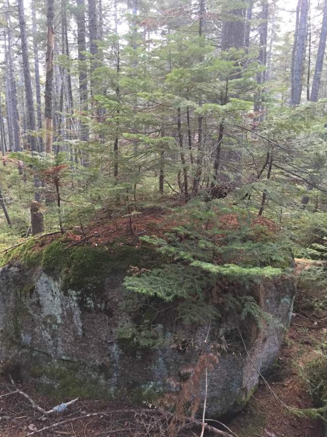
Winter wonderland trails, like our very own NarniaView from Jackson- up on the left you can see Bretton Woods Ski Resort and thats the Mount Washington Hotel in the middle. The red roof is really easy to see up on the mountain, not so much in the photo!It’s really important to remember to bring food for yourself AND your dog. We bring a bag of Mizpah’s food for her to eat on the trail, and a water bowl!Yep, that ice is the trail, crazy!!For hiking on ice….here are my La Sportiva Nepal mountaineering boots, Grivel crampons, and EMS Gaiters (similar here) . Winter hiking is pretty awesome if you like to collect gear!The rest of the Presidential Range from Mt. Pierce- the ridge to Mt. Eisenhower looks so cool. Mt. Washington’s summit is in the clouds.
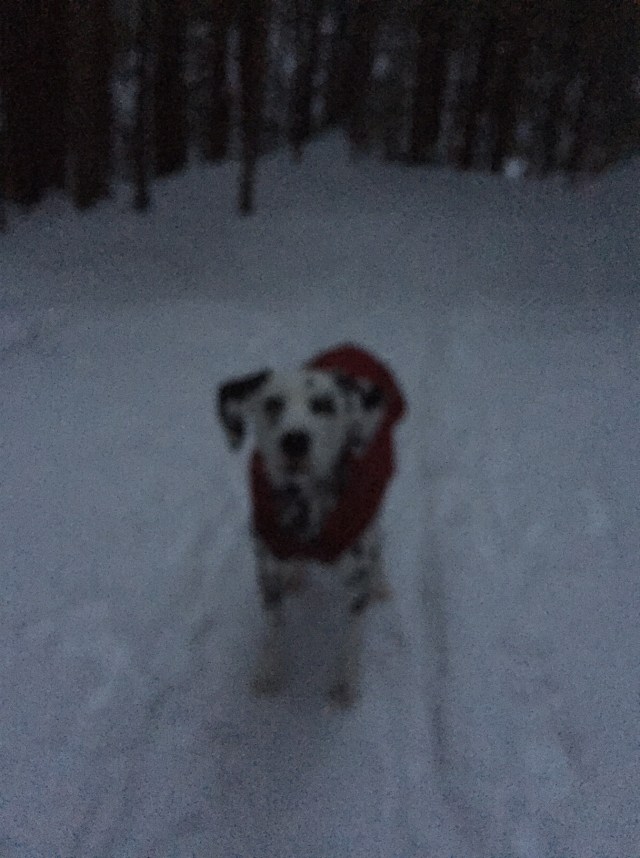
Frozen waterfalls on the Crawford Path down from PiercePicturesque little pup in her Ruffwear jacket and collarHad to take a quick snap on the way home of the Mount Washington Hotel and the Presi’s
My fiancé broke his toe the other day soooooo we might not be hiking again until April! Poor guy. I had already done these two mountains, but we were with a friend sort of new to hiking and wanted a short hike with nice views for him. This hike was about 6 1/2 hours. I still have 9 peaks left to finish the New Hampshire 4000 Footers. Goal is to finish by the end of this summer!
Hiking, horseback riding, trail running, swimming, biking…I love anything that gets me outside. What do you like to do to get outside? Do you have any outdoorsy goals for this spring/summer??
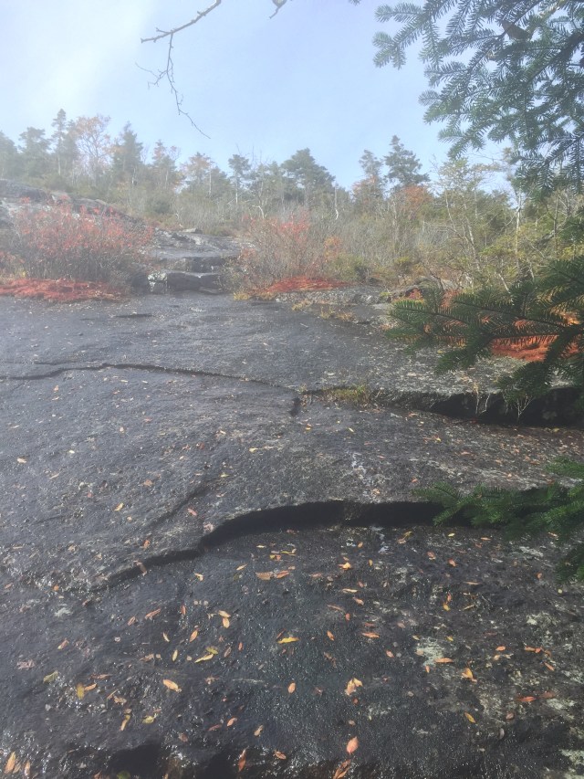
Yesterday I hiked North and Middle Tripyramid in the Sandwich Range Wilderness of New Hampshire’s White Mountains. They are both little guys, just over 4,100 feet. They are #38 and #39 out of the 48 4000 footers in New Hampshire for me!! We got started just after 10 AM up the Pine Bend Trail to the Mt. Tripyramid Trail. I was able to bareboot it on the trail until we started to climb. Then I had to throw my snow shoes on. Showshoeing for miles, climbing in elevation…..it is hard. This was an in and out hike-we went up over North over to Middle and then back again. There is a South Tripyramid that doesn’t count for “the list” even though it is over 4000 ft because there is not enough elevation dip and gain between Middle and South. If we weren’t pressed for daylight, we would have gone over- maybe when I do it again in the summer sometime.
The White Mountains is a Winter WonderlandPine Bend Brook and our baby girl, Mizpah
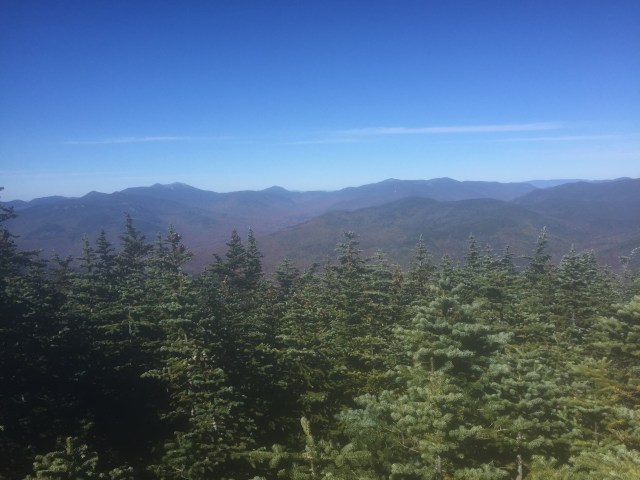
There are really no views from North Tripyramid. Every once and while, peaking out through the trees, I could see the Presidential Range, Mt. Washington’s recognizable white peak. You can see Mt. Carrigain over that way and the Signal Ridge too.
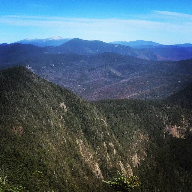
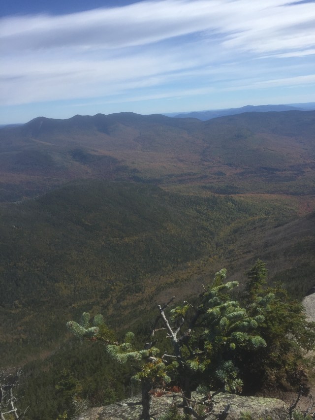
It was just a quick half hour over to the Middle Tripyramid, and there were some nice views from there. We could see the Waterville Valley Ski Area, Tenney Mountain Ski Area, and we could even see all the way to Killington Ski Resort in VT. We could see Lake Winnipesaukee and Gunstock Mountain Ski Resort too, but I just couldn’t get a decent picture. The Tripyramids are sort of central, you can see a lot of other familiar mountains from there.
Waterville Valley Ski Resort and Mt. Tecumseh, then way in the back is Mt. Moosilauke, and then back to the foreground, the OsceolasSummit of Middle Tripyramid- tiniest cairn, Mizpah, and then me and Jon’s his and hers La Sportive Nepal’s in snowshoes.Another view from Middle, the prominent peak on the left is Passaconaway and then next to that is Whiteface. All the way to the left in the distance is Mt. Chocurua
It was a hard hike, coming down off North Tripyramid I had to “buttslide” for a lot of it because it was too steep to actually walk down, you just slip and slide anyway. I could have put my crampons on my boots, but honestly crampons are scary and if you think you are going to misstep, they really shouldn’t be worn. You can slice your leg or your hiking companions by mistake with a crampon. My crampons are for climbing up sheets of ice only.
Mizpah came along yesterday, but chances are this will be her last long hike until the weather warms up again. She loves hiking, loves the journey, but girlfran just isn’t equipped for the weather up there. Her paws get cold and no matter what we try- different salves/waxes, many brands of booties- we just can’t find her any relief besides just sitting the hike out. Her little Ruffwear jacket keeps her body warm, but those paws….
Finishing the hike just before dark
So I am now down to single digits. Just 9 mountains left to struggle up 🙂 Then I will probably want to do them all in the winter…..or do the additional 4000 footers in Maine & Vermont…or just hike with my lovely fiancé Jon as he works toward the grid (all 48 in all 12 months). I hope you all had a great weekend, I will takin it easy today, nursing some sore muscles. I am thinking it might be time to do a winter hiking gear post…there’s a lot….if you like buying gear, def get into winter hiking ha!
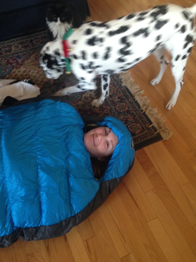
Those of you that read my blog or check out my instagram photos know that I am an avid hiker in the White Mountains of NH. Besides being on the back of a horse, being out on the trails is my other happy, calming, mind-clearing place. I have a lot of gear now from hiking and camping up there over the past few years, but I have been in need of a good backpacking sleeping bag. My fiancé got me the REI Flash sleeping bag, rated for 32 deg F. He also got me one of those blow up crash pads to go with it.
Making sure it was long enough on Christmas morning! Mizpah and Patty Cat very interested 🙂
We hike all through the winter. I have La Sportiva Nepal boots, gators, waterproof pants, microspikes, crampons, and snowshoes….gear is really important in the winter. This sleeping bag will be at the bottom of my pack this winter, because you always have to be ready to survive in the cold in the case of an emergency. Bag and tag is what Jon calls it. Jon always brings his, and now I will have mine too, just in case. It will also be perfect for some of the overnight hikes we have planned this summer for me to finish the NH 48 4000 footers!
It might sound corny, but this sleeping bag is more than just, “I wanna camp with you”. For winter hikers, this sleeping bag is more like, “I wanna keep you safe and warm always”. My sleeping bag just became a way more romantic gift huh?? Plus I know he probably spent hours researching which bag to get me!
Wow, last week was crazy! My goal is to do at least 3 posts a week, and I failed terribly last week. Good news is I finished my grad class for the fall semester, and just about finished my Christmas shopping! Woo! High fives all around!
Two holiday/Christmas parties, an awesome charity 5k run, and hiking South and North Hancock sums up my weekend. I am definitely feeling a little worn out today. The Hancocks are #36 and #37 of the New Hampshire 48 4000footers for me, so I just have 11 left! It has been an amazing journey, and honestly once I finish, its not really an ending. Hiking in all seasons here in New England has become a very happy and healthy part of my life, I love it, its right up there with horseback riding 🙂
This hike is a lollipop hike. You go walk a pretty flat trail down the Hancock Notch Trail to the Cedar Brook Trail to the Hancock Loop Trail. Then you start to climb and can choose to head toward North or South first. We went to North first because that trail is rougher terrain which is easier to climb up. We went up and over North which has nice views, over to the tree covered South summit, and then back down to the stick of the lollipop.
Summit of Mt. Hancock, the North peakView from the outlook on North, almost right at the horizon you can see Lake Winnipesaukee in the middleAnother view from the outlook, over to the right you can see the ski trails on Loon Mountain
It was such an unseasonably warm day, no jacket needed. I did wear my microspikes for 2 sections.
Summit of Mt. Hancock, the North peakArrowhead Slide on North HancockBack of the Franconia RidgeNew rerouted trail away from the brook, really prettyThese trees will grow, even if they have to grow out of a rock 🙂
The red bows on the summits of both peaks were a surprise. I enjoyed them, BUT they do violate the Leave No Trace policy we all try to hike by. Its tough, most hikers that consider themselves stewards of these ranges don’t approve of anything that could become litter or could disrupt the existence of the animals/plants living there. The fact that this little decoration is in support of the holiday season also ticks some off, nature is neutral I was told. I hope that whoever put them up will come back to dispose of them, but I don’t see harm in the intent behind them. I am a holiday romantic, what can I say??
And on that note, yesterday was National Hot Cocoa Day! I celebrated with a mug that I painted at Clay Time in Shrewsbury MA. I used really cool silk screens to decorate my mug, it was so fun!
Hope you all had a good weekend! I will be better this week about posting, promise!
I hope that you all had a good Thanksgiving and a great weekend!! I spent the weekend up in NH with my fiancé and his family. We celebrated Thanksgiving on Thursday, and then his birthday on Saturday with an awesome hike to #optoutside on Friday in between.
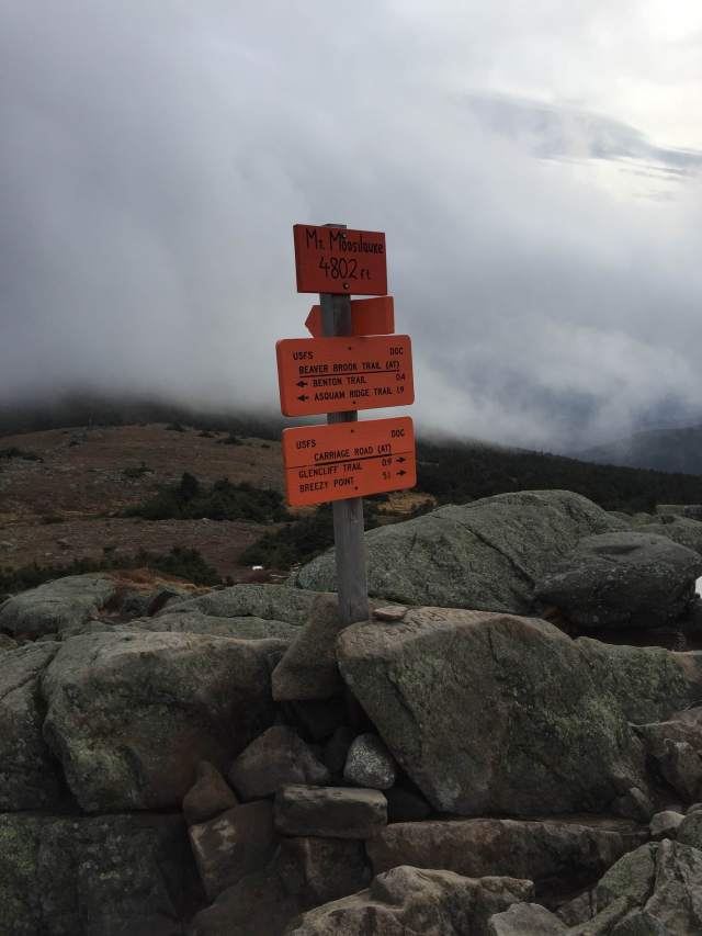
I only have 7 hikes left to complete the NH 48 4000-footers…..but they are all pretty long. We wanted to be back, showered, and ready to go for dinner & drinks at Poor People’s Pub (good grub, cheap beer) Friday night, so we chose Mt. Moosilauke for our hike. The trail we picked, the Gorge Brook Trail, had a book time of 5 hours. We did it in 4.5, but we had to add an hour because the gate to the access road was shut and locked so we had to walk another 1.5 miles in and out from the trail head. That happens in the fall/winter.
The Gorge Brook Trail, Al Merrill Loop, Ridge Trail, and Snapper Ski Trail all start near the Moosilauke Ravine Lodge. The lodge and bunkhouses are owned by the Dartmouth Outing Club (DOC) from Dartmouth College in Hanover NH. The DOC is legendary in the White Mountains. Their love for outdoor activities, particularly winter sports has made the White Mountains what it is today, a region dotted with ski resorts, and home to cross country ski trails, snowshoeing trails, and backcountry skiing. Really many of the first mountaineers in the Whites were from the DOC, some from Harvard too. These were the first mountaineers out west in many cases too. They were men that loved sport, competition, and endurance….and had the privilege and opportunity to travel and play in the mountains.
I have already hiked Mt. Moosilauke from a trail on the other side of the mountain, Glencliff, so this was my first time seeing the lodge. It’s really neat, bunkhouses named after different classes, a swimming hole for the class of 07, and the lodge itself is huge! They offer lodging to the public, students/alumni get a discount, and offer meals too. It’s also home to the trail crew, a group of students that maintain 17 cabins and ~50 miles of trails between the lodge and the campus in Hanover.
Ivy league bunkhouses folksWalking up the main lodge, it’s huge!!Tried not to be too much a paparazzi, but I loved this bunkhouse. You can just barely see the screened in porch on the right with matching hunter green adirondack chairsThe lawn of the lodge- I picture frisbee games, picnics, and stargazing out here
The hike itself was great, trail was not too rocky, lots of rock stairs, some ice towards the summit. The trails are very well marked by orange signs and very well taken care of. There are a couple re-routes which can be annoying, but are also signs of good trail stewardship. For this mountain, they have been moving the trails up and away from the riverside because of erosion and damage from hurricanes in the past.
Mizpah is very attentive when we stop for a snackSelfie with Miz!
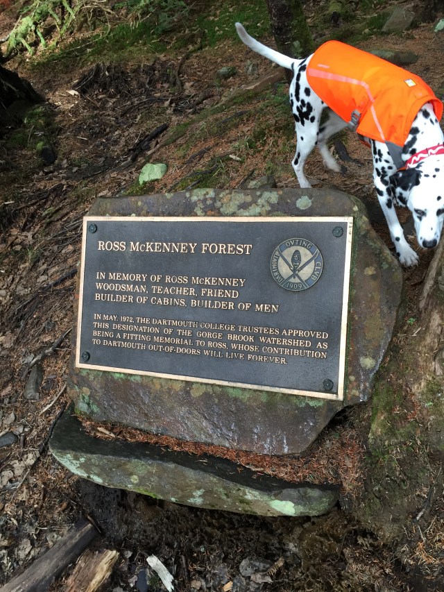
Dartmouth owns the Gorge Brook watershed, something like 4500 acres on Mt. Moosilauke and the surrounding area. It is named after C. Ross McKenney, an avid woodsman who oversaw the building of the main lodge in 1938. The lodge was saved after many years of disuse in the 50s by Al Merrill, the Director of Outdoor Programs and Ski Coach at the time.
Memorial for Ross McKenney at the last sure water stop
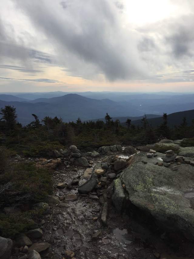
The summit of Moosilauke is above treeline. It can be extremely windy up there because its the furthest west of the 4000 footers and catches undeterred wind all the way from Vermont. There is a stone foundation up on the summit, the remains of an old hotel up there in 1860. It was first called the Prospect House, later called the Tip Top House. The Carriage Road Trail was originally used to reach the hotel. It was lovingly run by Dartmouth students from 1920 until it burned down in 1942. The hotel on Mt. Washington was also called the Tip Top House. I just couldn’t get a pic of it on this hike, the wind was gusting to ~50 mph. It was tough to stand up and walk at times.
Freezing in the wind on the summit, couldn’t take too many picsMuddy paws and ears flapping in the wind
I absolutely love the history in the White Mountains. All the old hotels, mountain huts & shelters from a time when the train was the only way to get up there. To see what it looked like up there in its hey day. Not all of it was good of course, the White Mountain National Forest was almost leveled for lumber and to create farmland. I definitely prefer it with the trees, but the glimpses of the past are much appreciated.
I would like to explore the lodge more when its open. They open in May and close November 1st. Don’t worry, my fiancé is doing the grid for the 48, so he has done Moosilauke in 3 months so far, 9 more to go!
What did you do to #optoutside on Friday? Have I inspired anyone to come to NH and see the Ivy League accommodations at the ravine lodge? Please say yes! 🙂
This past weekend we headed up to NH for a hike and an Oktoberfest/Halloween get together. Its true we are past peak with foliage in NH but its still gorgeous out there. Past peak still means a lot of yellows and rusts and browns. Its still so colorful out there. Mt. Major is a little guy, and there are a couple ways up. There is a steeper & quicker route and then a more windy & gradual route. We had my future inlaws with us so we decided to take the more gradual route. Our pup was staying with them while we headed to the party, so we had to make sure Mizpah was tired and not crazy for her babysitters.
Nice wide trails hereGolden morningLake Winnipesaukee, amazing colorsWe forgot my LLBean backpack but thankfully Jon had his from elementary school haGirls on the summit, wearing my LLBean Sweater Fleece pullover, so comfortable and a great top layer for this hike!
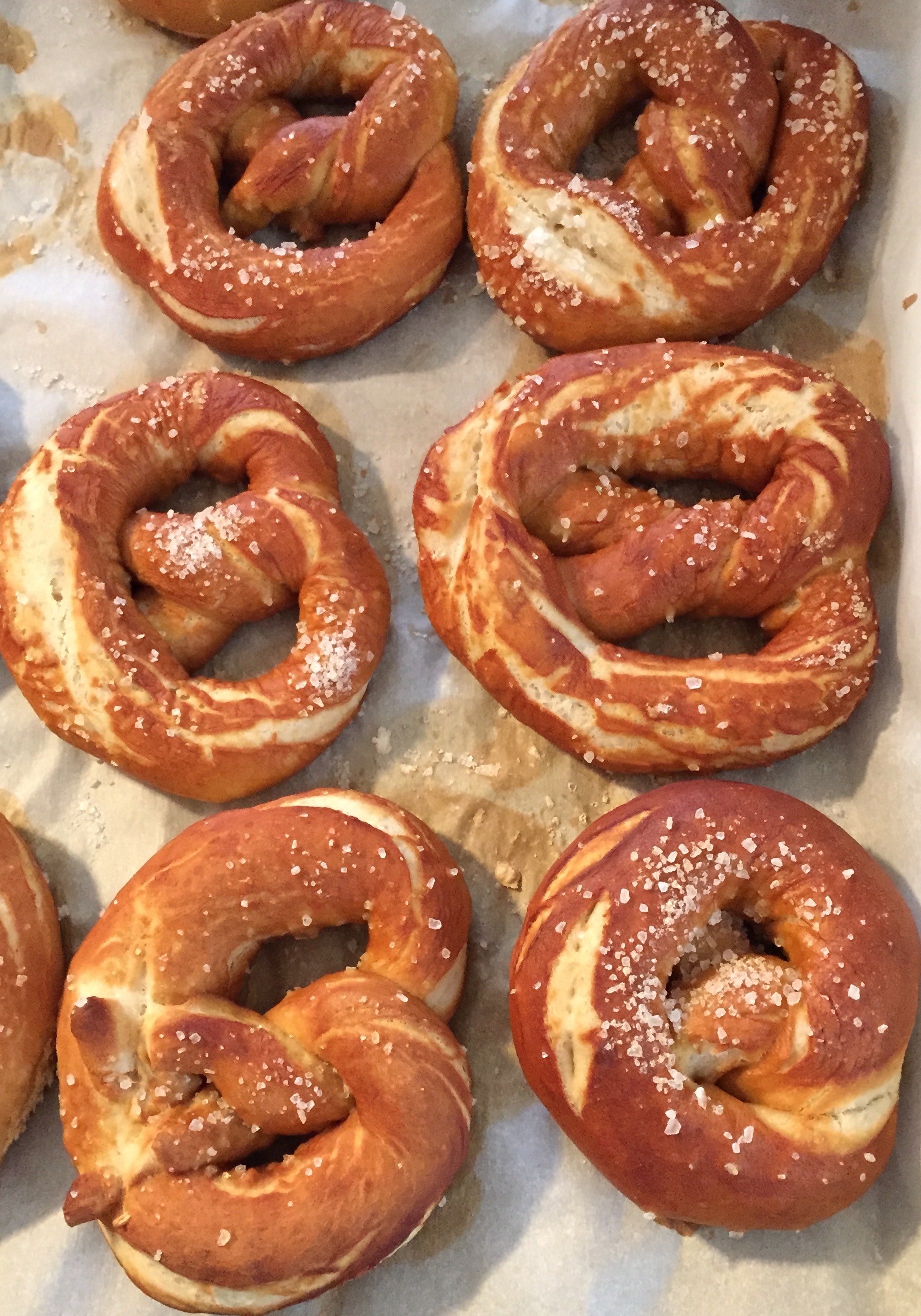
I don’t know, I feel like the leaf peepers miss one of the best phases of foliage after Columbus Day weekend. It was so gorgeous Saturday. After the hike my amazing fiancé made homemade soft pretzels for the Oktoberfest/Halloween party. I bought pumpkin bread from my favorite country store and he made homemade perfect pretzels, he’s definitely a better cook haha.
Homemade Oktoberfest Pretzels
For the party I wore an old Oktoberfest beer girl costume that I got years ago, and my fiancé Jon wore his waders as waderhosen with a fishing buddy and they both had the German hats with the feathers. It was fabulous.
It was a great weekend. The hike cost us nothing but gas, we didn’t have to buy anything for our costumes, we just bought stuff for the pretzels, the pumpkin bread, and some German beer which was delicious.
I hope you all had a lovely Halloween weekend! The last horse I wrote about was a tragedy. Tomorrow I will write about a horse that is an inspiration, and a triumph, and thankfully has a very happy ending coming to him 🙂
I think it was Monday night that I got the email from REI that they were closing on black Friday, the day after Thanksgiving. REI is a coop company where once you join the coop, any purchases get chronicled, and you get money back each year on your purchases. I have gotten camping & hiking stuff at REI in the past. Black Friday has become a day of American consumerism like nothing else. The time for stores to open has pushed all the way to basically after dinner on Thanksgiving Thursday. The first year I headed up to NH to be with my fiancé’s family after Thanksgiving lunch with my family, there was traffic. I was shocked, how could there be traffic going through his town? It was because of the Walmart. I was driving to get to dessert with those I love, and got stuck in traffic with people going to get the best deal on a new flatscreen.
REI’s campaign asks us to go outside on Friday after Thanksgiving- get out of the stores, get off our computers, and do something outside. They created the hashtag “opt outside” for all of us to showcase our non consumer driven activities. Its fine with me because we were already planning to hike in NH. I still have to do the Tripyramids, Hancocks, and Cabot this fall/winter.
Will REI reach a new group of people to be customers? I don’t know, its a pretty specific audience that goes to REI. Maybe the campaign will inspire people to go buy new outdoorsy items for their #optoutside adventures. Maybe REI will even toss us some sales beforehand to help us get outfitted for the day. Will other companies join REI in closing on Black Friday? I don’t know. Think about everyone being able to spend all of Thursday & all of Friday with their families. REI’s 143 stores will be closed on that Friday and every employee will get paid to go do something outside! Can someone start paying me to play outside?! Here are the little YouTube videos they have created for the #optoutside campaign:
Opting outside will cost me gas money, and maybe a parking fee depending on which mountain we go to. Sooooo much cheaper than whatever I would ever buy on black Friday. Go outside more, spend less.
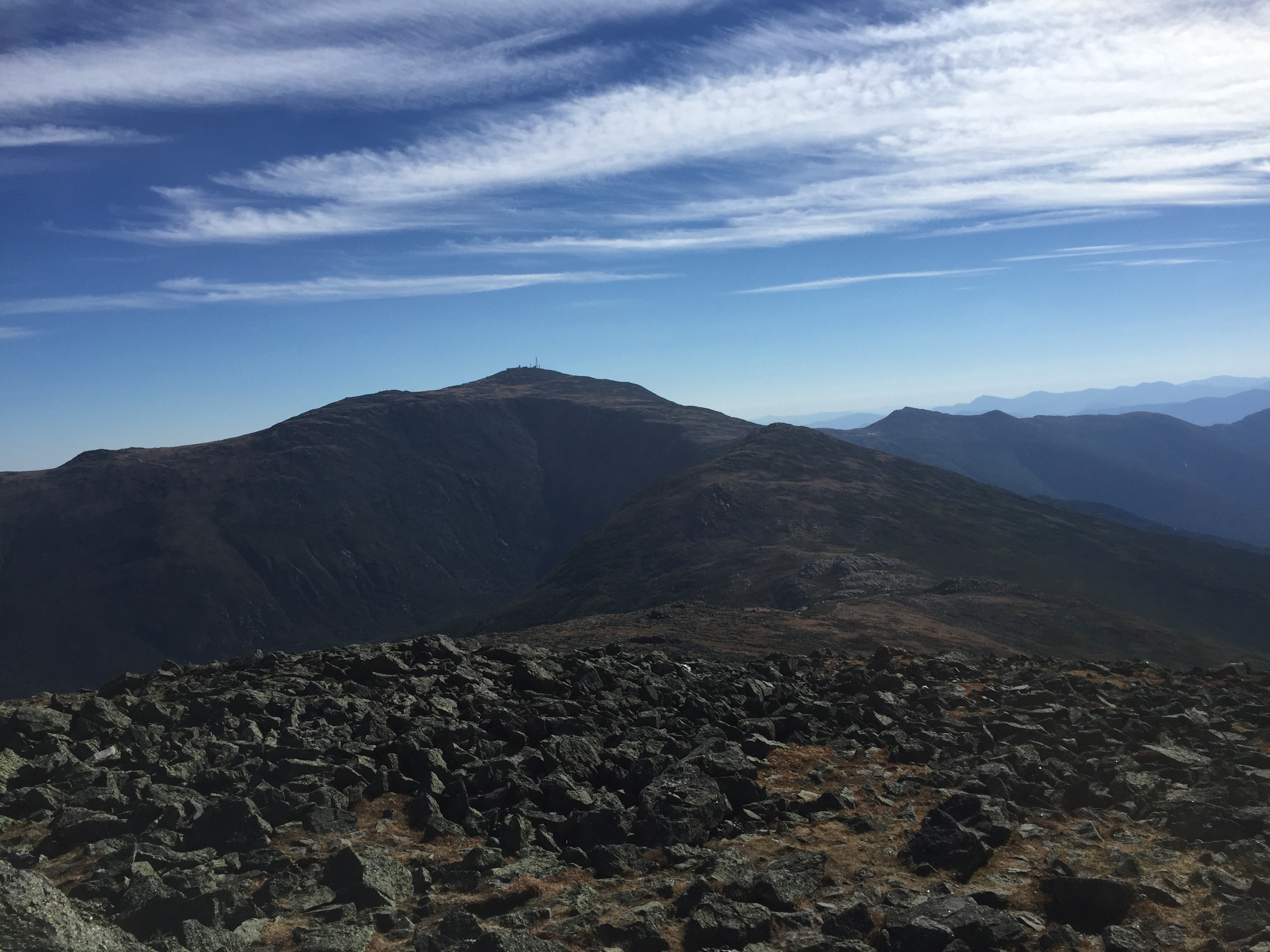
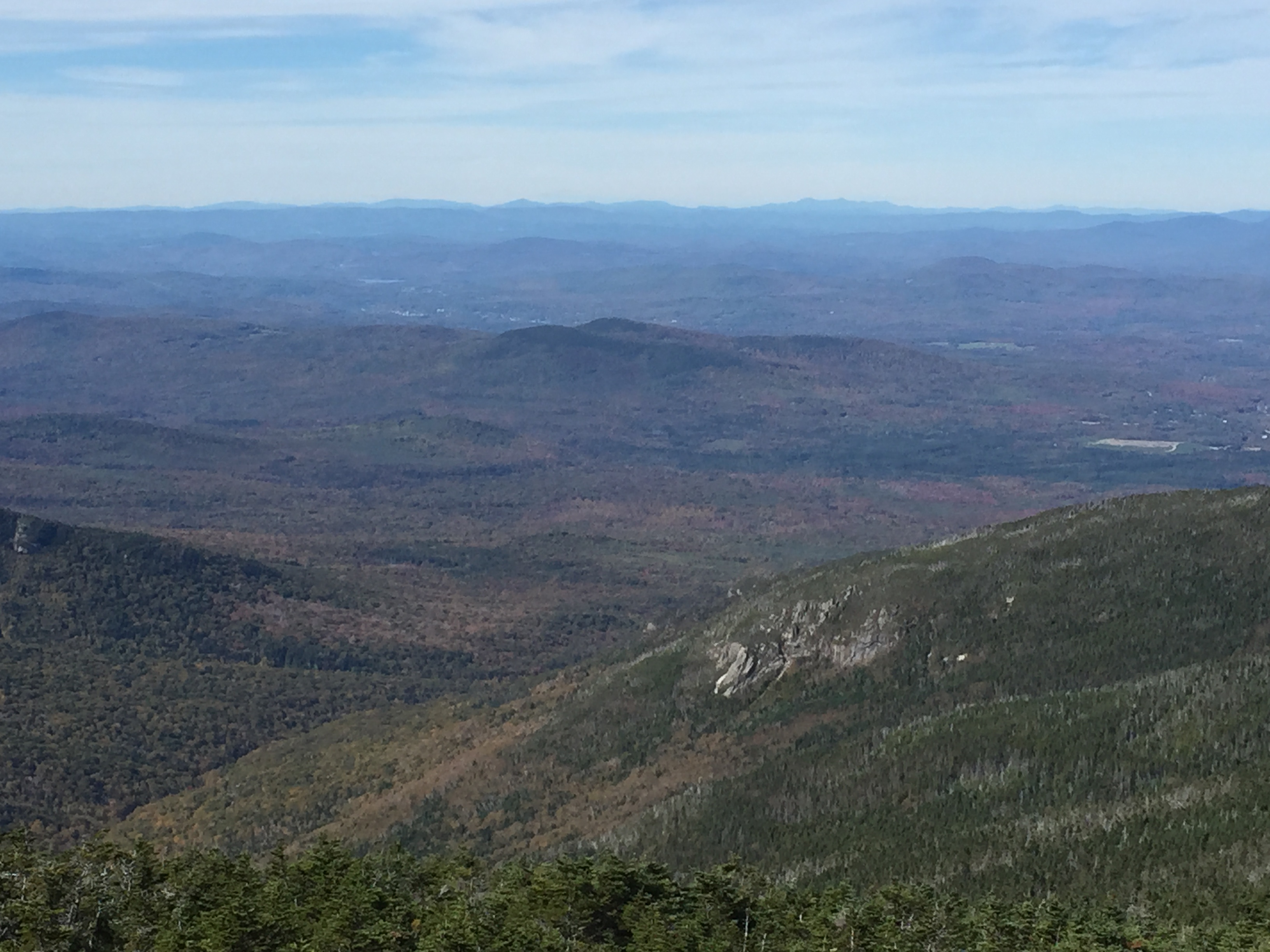
My fiancé doesn’t normally get Columbus Day Monday off, but he took it off this year and we are so happy he did. We hiked Mt. Jefferson in probably the best weather you can ask for on the Presidentials for this time of year. We started up the Jewell Trail at the Cog Railway Base Station. Oh my goodness, it was so crazy. I wonder how many people took the train or drove up Mt. Washington this past weekend.
The trail is beautiful, just roots, some rocks but not too bad. The trail eventually pops you out above the trees though and you are exposed with the most beautiful views for the rest of the hike. There were some rocky sections above treeline. It was in the 50s, and a little windy above treeline. It was really sunny, which I love, but you have to be careful with sunscreen up there because there’s nothing shielding you. It was a beautiful hike, definitely a long day after hiking the Osceolas just a couple days before. Jefferson was the last mountain of the Presidential Range that I had to hike, #35 over all of the NH48. The colors in the mountains were beautiful on Monday, I think that was the official peak of colors for foliage in the Whites.
Chocurua Lake- I couldn’t resist stopping to snap this on the drive up to the trail headLove fall in New EnglandView on the way up the trailView from the top looking down over the base station and past that, Mt. Washington HotelView from the topLooking over to Mt. Washington, see the observatory station on top?Mizpah chillin in the alpine meadow
It will be a few weeks before we can head back up to hike again, probably not until November. In other news, today, October 14th is National Dessert Day!!! I swung by my favorite local bakery in my area, Bliss Bakery, to grab a couple dessert items to celebrate the occasion. If I am going to spend money on bakery items, meaning I am not just making it myself, I would always rather go to a nice local bakery. This past Easter, I had a lot of family over for lunch and we got a lemon custard tart topped with berries and a macaron assortment from Bliss. Here are some of the beautiful Easter egg macarons:
It’s Wednesday, just two more work days until the weekend AND you have an excuse to go get a little treat. Another reason why I like getting my treats at a cute local bakery is that I like to look at the selection and pick something. It’s fun! It’s also good for my diet though because one special cookie is better than buying a whole bag of cookies that I wouldn’t enjoy as much. Happy National Dessert Day! Hopefully you have had a sweet day!
Sorry I have been MIA, it has been a busy weekend of hiking, horse shows, & football!! I love Columbus Day Weekend because it usually the peak of the fall foliage in New Hampshire. This year did not disappoint. Saturday was a cooler day, and the trail was a little wet from rain on Friday, but we managed to get up and down East Osceola and Mt. Osceola, 2 4000 footers on my list 🙂
I have never seen as many people leaf peeping up in the Whites as we saw this weekend. Sunday night they were estimating ~660,000 people were traveling in NH for the foliage. That’s crazy, and really awesome for NH’s economy. Many inns/hotels/campgrounds that we passed were full up and many parking lots for scenic overlooks were packed with traffic causing lines to get a picture of the beautiful colors painted across the mountains that have become like a second home.
Anyways, here are some pics from the hike!
View of the mountains from the ascending trail
Thank goodness we didn’t have to climb this. Our trail had something similar, but had some foot holds at least!
Mizpah in her fall jacket on the misty trail
Mt. Washington snow covered in the upper left area!
From the summit of Mt. Osceola
View on the way back down East Osceola, easier to see some color there!
There are no views from East Osceola, just a cairn signifying that you made it, and even then you are supposed to walk down a small trail for about 60 yards to the true summit, something you would only know from reading the Appalachian Mountain Guide site. Mt. Osceola is where the views are at!
Standing up there on the summit, the colors transform the landscape. Its hard to see in the foliage in the pictures, definitely easier to see at the lower altitudes. Up in the 4000 footers, what you see is evergreens. I got some better foliage pics on today’s hike!
We went up via the Greeley Pond Trail to Mt. Osceola Trail. We think that coming up from the other side might be easier? There is a chimney (rocks that are arranged so you have to climb and squeeze through like Santa) between the Osceolas and a slide thats a pain when its wet…which it was…on the Mt. Osceola trail just before you summit East Osceola. This was actually my third attempt at the Osceolas. Once, it was wayyyy too wet and I was tired from a hike the day before, and the other time, the trail had new snow and was a mess with post holes and we couldn’t deal. That happens, we always say, “to hike another day”, meaning make sure you are hiking in a way that will allow you to hike another day, the mountains will be there.
Hiking is one of the most rewarding ways to spend a day, physically & mentally. We saw lots of families and groups of friends which always makes me happy. There were lots of dogs as well, which makes Mizpah happy too!
I will catch up on the rest of the glorious Columbus Day weekend over the next couple days, promise! Hope you all had a great weekend, and to my Canadian friends, I hope you had a nice Thanksgiving!!
On Sunday, the fiancé, pup, and myself headed up to NH. I am working on hiking all 48 4000 footers in NH, and I now have 32 done!! It has been an amazing journey. North and South Twin was an 11 mile, 7 3/4 hour hike. It was long but beautiful. The views from the summits are unlike any I have seen yet. The Twins are right in the middle of many of the 4000 footers, so it was amazing to see so many mountains I have hiked all seeming so close. Walking through the woods for hours to come out in the open and see all the peaks that have become so familiar was breath taking.
Here is the Little River that you cross back and forth over a few times taking the North Twin trail. So pretty, but a little scary hopping on rocks trying not to end up in the river. On the way out, we took a detour so we only had to cross the river once.
After the river crossings, the trail turns and heads up to the North Twin summit. From there its around 45 minutes to the South Twin summit. Most of the pictures below are from North Twin. My pics from South Twin didn’t come out too great. There is definitely foliage up there, a lot of yellow right now though. I am hoping this coming weekend will have more orange and red!
Pretty sweet view up here!Just starting to see the color change to mostly yellowsMizpah looking out over her mountainsView of the Presidential RangeView of Franconia Ridge & Mt. Garfield
After a long day of hiking, we ate our homemade sandwiches, pickles, apples, and yes, some pretzel/cheese combos and headed home. There was a huge traffic jam for a moose on the way home. Looked like a young male moose just hanging out on the side of the road. We contributed to the curiosity traffic haha, it was pretty cool.
Hiking is such amazing exercise and is pretty much necessary for my sanity. Being out there just softens life’s craziness. My fiancé says it turns down the volume for a while. Pretty cheap adventure too, just need to pay for gas! This one didn’t even have the $3 parking fee!