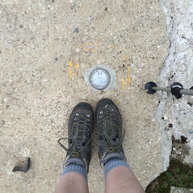
A while back we hiked Middle & South Carter in the beautiful White Mountains of New Hampshire but couldn’t do Carter Dome because my pup hurt her little paw pads. This past weekend we took a break from house stuff to finish the Carters. I now only have five mountains left to finish the 48 4000 footers in the Whites!! Woo! I have to hike the Bonds which is 3 peaks, Isolation, and Owls Head to finish up.
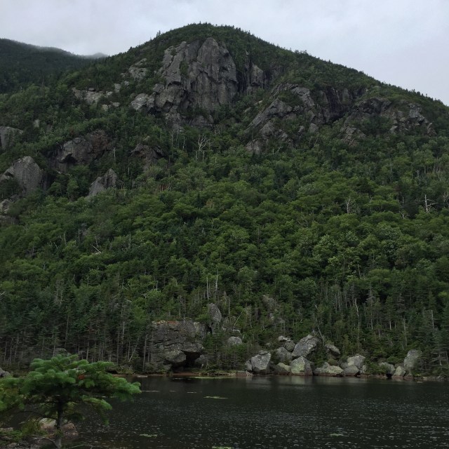
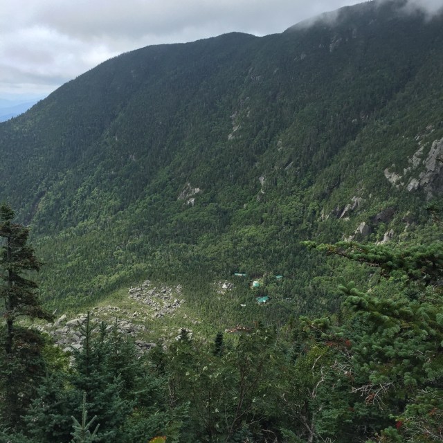
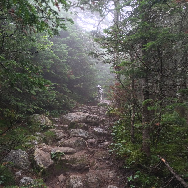
Mizpah playing in the 19 Mile BrookThe main building at the Carter Notch HutCarter Pond…check out that cloud creeping upAnother Carter Pond shotLooking down into the notch at the Carter Notch Hut. Those rocks down there look small, but they are the size of buildings!Looking out into the Wild River Wilderness from a view before the summitMizpah ascending into the cloud
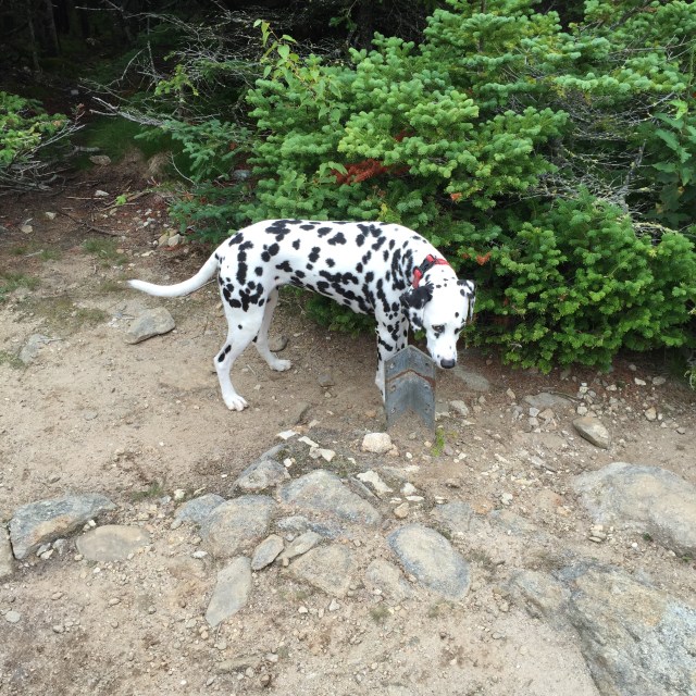
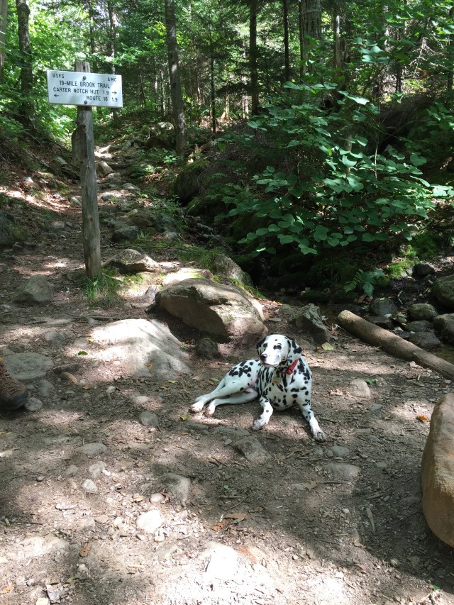
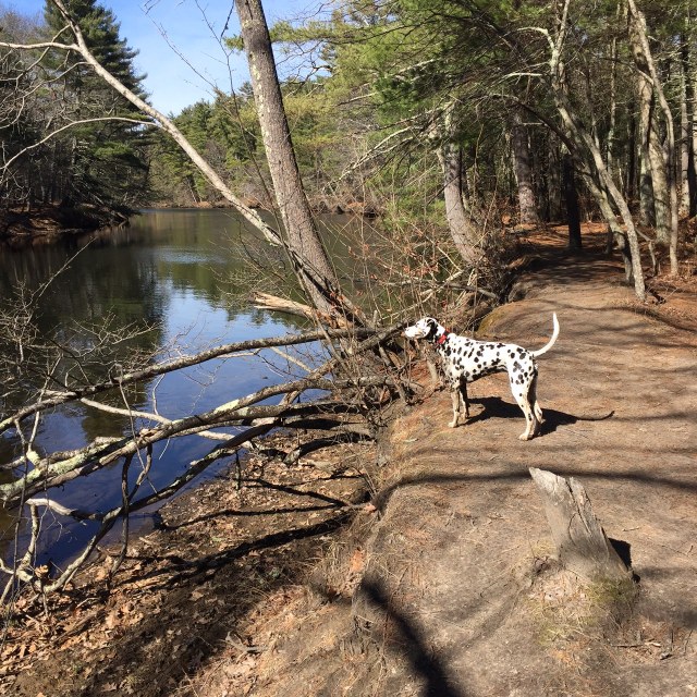
We went up 19 Mile Brook Trail to the Carter-Moriah Trail which has some steep parts to the summit. The Carter Notch Hut is off the Carter-Moriah Trail. This particular hut has different buildings for the bathroom, bunks, and dining area whereas a hut like the Mizpah Spring Hut has everything in just one building. The summit has the remnants of a tower which is cool even though it doesn’t have great views. We were in a cloud the day I hiked though so there were no views no matter what.
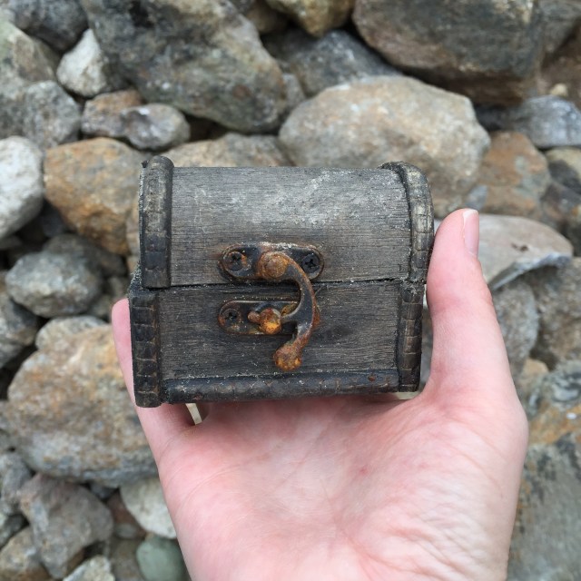
We thought this was a geocache in the rocks of this cairn near the summit, but the note inside was actually a very sweet memorial tribute 🙂My trusty La Sportiva Pamirs….these are my zombie apocalypse footwear….yes we have discussed what footwear we would grab for a zombie apocalypse.Summit!In a cloud on the summit!Mizpah investigating one of the old anchors for the tower that is no longer up there
We took the Carter Dome Trail back down to the 19 Mile Brook Trail which is a little longer, but not as steep. I would MUCH rather go up something steep and come down something more gradual for my knees’s sake. It’s better for Mizpah’s joints too!!
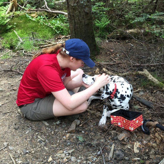
Yep, we handfeed Mizpah her food out on the trail. She never eats breakfast before we leave for a hike, so anytime we take a break, we offer her food to keep up her energy!Mizpah lounging trailsideLove the scenery on the 19 Mile Brook Trail!
It was a really great hike to do after taking a little time off. We even ran into one of my favorite instagrammers out on the trail- @munjoyboy. He was coming down Carter-Moriah as we were heading up. He has AMAZING photos of many of my favorite places.
Last week, I got to do a midweek hike with my sister who is just starting out doing the 4,000 footers in NH. We did Mt. Jackson and Mt. Pierce, which are the most southern 4,000 footers in the Presidential Range. This was actually my third time hiking these two, but first time in the summer!
We took the Webster-Jackson Trail from Rt. 302 to Mt. Jackson, and then the Webster Cliff Trail over to Mt. Pierce, and finally the Crawford Path back down to Rt. 302. It was my first 4000 footer hike without my husband, and so I felt a little pressure to make sure we were on the correct trails, going the right way and so on. Mt. Webster is up there too, named after Daniel Webster, but it’s not a 4000 footer so we had to make sure we avoided that trail.
Mt. Jackson is actually not named after Andrew Jackson, our 7th president. It is named after Charles Jackson who was a physician and the state’s geologist! On the way to Mt. Pierce, named for Franklin Pierce, is the Appalachian Mountain Club (AMC) run Mizpah Spring Hut. It was a really nice one. It made me miss my pup, Mizpah, but her paw pads were still healing.
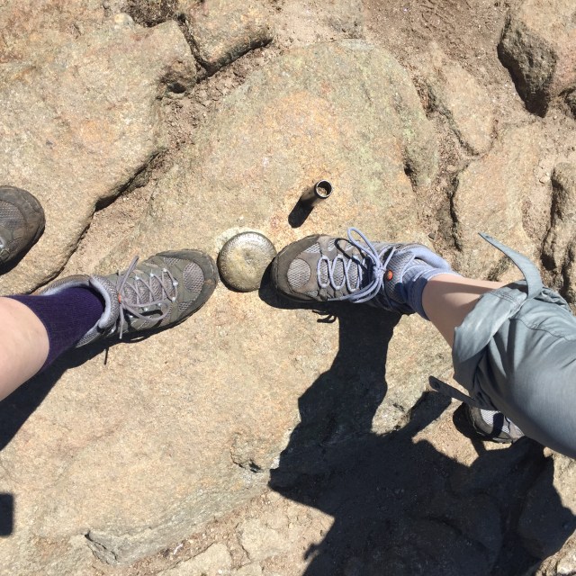
View down from Mt. Jackson. You can just barely see the Mt. Washington Hotel down there! Just to the right of center with that red roof!Sisters at the summit!The rest of the Presidentials from Jackson, you can see Washington perfectly high up on the right!Mizpah Spring Hut, just below the summit of Mt. PierceThe Mizpah bell in the hut, reminded me of my pup!Matching Merrell boots up on top of Mt. Pierce! Mine on the left are just really old haha. Mt. Pierce was originally named Mt. Clinton after DeWitt Clinton, a governor of NH.Just starting out on the Crawford Path, beautiful views of the PresisSomeone on the trail got really excited about my mountain hat, said he was friends with one of the Harding Lane guys! We probably could have had a nice convo if I wasn’t so awkward and unable to speak more than “hi, how are you, have a nice hike” haha
The Crawford family….you really can’t discuss the history of the White Mountains without talking about a few families, and the Crawford’s are definitely one. Abel and Ethan were father and son. They cleared a path up from Rt 302 to Mt. Pierce (Clinton then) over to Mt. Washington and guided hikers up. Abel at 75 years old in 1840 ascended this trail to Mt. Washington on horseback!! The path is just over 8 miles and goes over Mt. Eisenhower, Mt. Monroe, past the Lake in the Clouds, and ends up at Mt. Washington’s summit.
It was a really hot day which meant drinking lots of water. Having the hut was nice to fill up and not have to worry about running out of water. When we finished our hike, we headed to the Woodstock Inn Station & Brewery for a beer and some food. So delicious. I got the chicken salad melt which is an open faced sandwich on their spent grain bread, and my sister got a bison bacon bbq burger. We both got their summer beer which is deliciously light and refreshing. It was just a great day with my sister, so thankful to be able to hike with her!
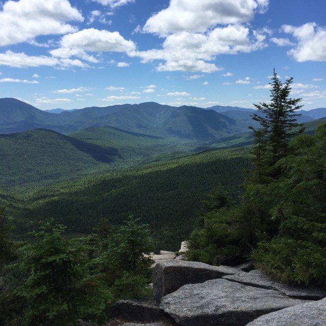
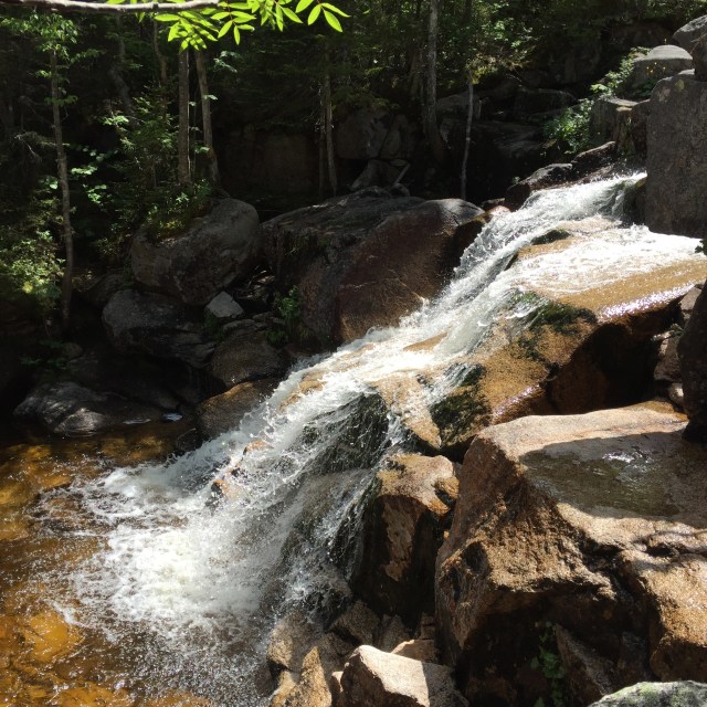
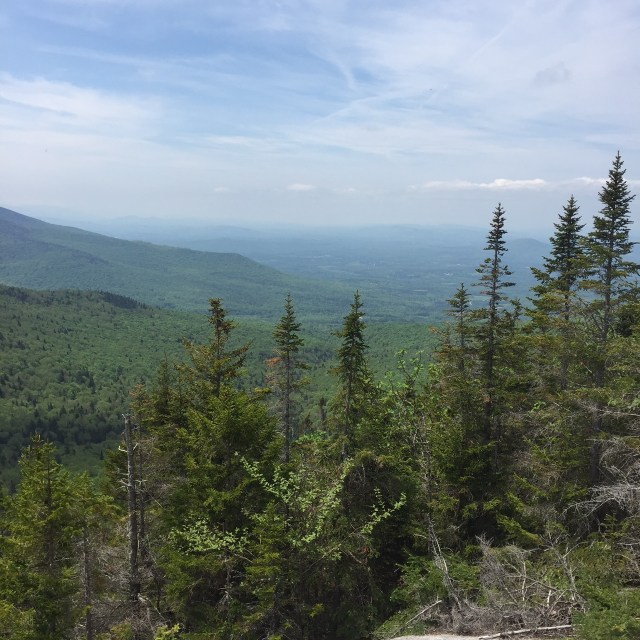
We stayed at the Mt. Washington Hotel last week for a few days, and of course had to do a hike while we were there. The trailhead for Zealand is just 15 or so minutes from the Mt. Washington Hotel. Its a longer hike distance wise, but only took us 6:30 to do! The Zealand Falls Hut is on the way, and past it you can see the falls. The falls are beautiful. Zeacliff has beautiful views on the way to Zealand. Zealand’s summit doesn’t have views, it is tree covered.
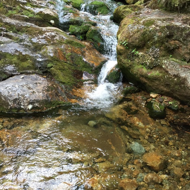
Beautiful scenery on the mostly flat first few milesThe falls on the way upThe view from ZeacliffLooking out over Carrigain and the Hancocks from Zeacliff. I did this same hike in November 2014 and this was all covered in snow!!The summit of ZealandMore of the falls on the way downThe Zealand Falls HutOne of the last little lady slippers of the season all by itself out on the trail
Interestingly, the Zealand Recreation Area you see off of 302 before the trailhead which is up the road a bit is where a small town used to be. Zealand was a town set up by J.E. Henry from Lincoln that had a boarding house, school, and a dozen homes. John Henry was into logging, and once they clearcut the entire wilderness in that area, they picked up and headed back to Lincoln leaving behind the town. The buildings all burned down between 1886 and the turn of the century, and the town faded into the past. There were many abandoned and now almost forgotten ‘company towns’ built for the logging industry in New Hampshire. Anyway, it was really cool leaving this hike and instead of just driving by the Mt. Washington Hotel, turning down the drive to our room!
I am two peaks closer to finishing the New Hampshire 48 4000 footers! The original plan was to do Middle & South Carter and then Carter Dome but we had to turn back after South Carter. Descending from South Carter to the Zeta Pass before you head up the dome, we noticed Mizpah trying to lay down every time we stopped which is really weird for her, and then she actually limped holding up her left hind paw. We took a look at her paw and sure enough, she had a rip in her paw pad. We decided to head back, which did mean 4 miles of hiking down still. My little baby made it down ok, she sort of limped if there were rocks but walked ok on the nice packed dirt. Today she is doing better, she is tired but she did make it down the stairs ok and is eating/drinking.
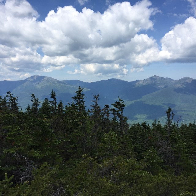
The two peaks we did don’t have views! I did take some pictures of the beautiful northern Presidentials from an outlook on a little summit before Middle Carter. I guess the really nice views are on Mt. Hight which is not technically a 4000 footer in between South Carter and Carter Dome. I have to go back up to do the dome so I will get to snag those views then!
This is the view of Lake Winnipesaukee from Mt. Major on Saturday!! We did the little Mt. Major with Jon’s parents on Saturday, it was such a beautiful day. Mt. Major was packed!Sunday was the ATV ride up the Mt. Washington auto road!! They shut down the auto road and only allow four wheelers up. The line of trucks and trailers was miles long in the morning.
Above is a picture of Camp Dodge, where AMC volunteers and employees can stay in the summer. We parked at the 19 Mile Brook Trailhead because thats where we were going to end, and walked up the road a bit to Camp Dodge and got on the Imp Trail towards Middle Carter there. It was cool to see Camp Dodge!
View of Mt. Washington, Mt. Jefferson, Mt. Adams, and Mt. Madison from an outlook by Middle CarterMizpah pre-pad tearMizpah post-pad tearLittle waterfall in the brookReally nice new bridge on 19 Mile Brook Trail.
We have some more hikes planned in the next couple months, so hopefully I will finish the 4000 footers this summer! Mizpah’s paw will heal, she just needs time. Its just so hard to watch my super athletic girl struggle and limp around. Friday was my last day of work until August 22 🙂 Let the summer adventures begin!!
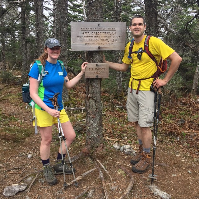
Well another Memorial Day weekend has come and gone. From what I have heard, Sunday was a miserable day in most of New England, but it was a beautiful day in northern New Hampshire on Mt. Cabot! Mt. Cabot is the farthest north of the 4000 footers up in Berlin NH. The trailhead is at one of the NH State Hatcheries, soooooo many trouts!!! We were already up at my inlaws’ house in NH, and from there it was still another 2.5 hours to drive. My sister, Brenda, came up to do this hike with me and my husband too! This was her 3rd 4000 footer, my 40th 4000 footer, and who knows what number it is for my husband haha, over 100?
So we went up Cabot via the Bunnel Notch Trail to the Kilkenny Ridge Trail. In total, the mileage was a little over 9 miles- took us about 6 hours. The trail was in great shape except for some mud which is normal for this time of year. It was a really warm day, many water breaks. There are some nice features along the way- a spot with some beautiful views, an old fire warden’s cabin that you can stay in, and a clearing close to the summit that has the remnants of an old fire tower. Many people stop at the tower clearing thinking that they have made it to the summit…but really you have to continue on and you will get to another clearing with a sign that says Mt. Cabot-4120′, and that still isn’t the summit, you have to go a little further to the true summit at 4170′. Two false summits. We saw many people at the fire tower clearing that never continued on to the actual summit.
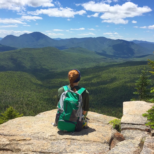
Green lush scenery has returned to the White MountainsMy sister and I love our LLBean Backpacks. Mine on the left is here and my sister’s on the right is here. My pack is smaller, more appropriate for a little day pack, and my sister’s is a little more appropriate for an overnight too.The girls at the view, Mizpah, me, and BrendaThe views were a little hazy on Sunday, but still beautiful. Everything is so green again!!!The old fire warden cabin near the summit of Mt. Cabot. The only cabin I have seen in the 4000 footers higher elevation. There are shelters, and then the AMC huts, and cabins at lower elevations, but this is a unique fixture.False summit #2 haha, me and JonStopping at the view for a little break on the way down. Best hiking dog. Love her.
On the way home, we stopped at Mountain Fire Pizza in Gorham NH for some dinner and a beer. Jon and I split the maple and bacon pizza, it was amazing. My sister got a pizza with chicken and artichoke on it, it looked great too! If you like thin crust brick oven pizza, then this is the place for you. Gorham is an interesting town, way up in the mountains. We went to Gorham last year for 4th of July fireworks when we were camping at Dolly Cop. ATVs are street legal in the town. Think about that for a second, you can drive 4-wheelers anywhere…to McDonald’s, to get some pizza, to pick up a friend, whatever. Pretty cool place. More pics from Memorial Day on Lake Winnepesaukee tomorrow!!
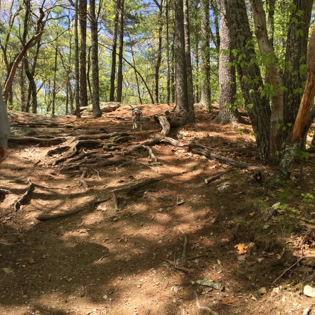
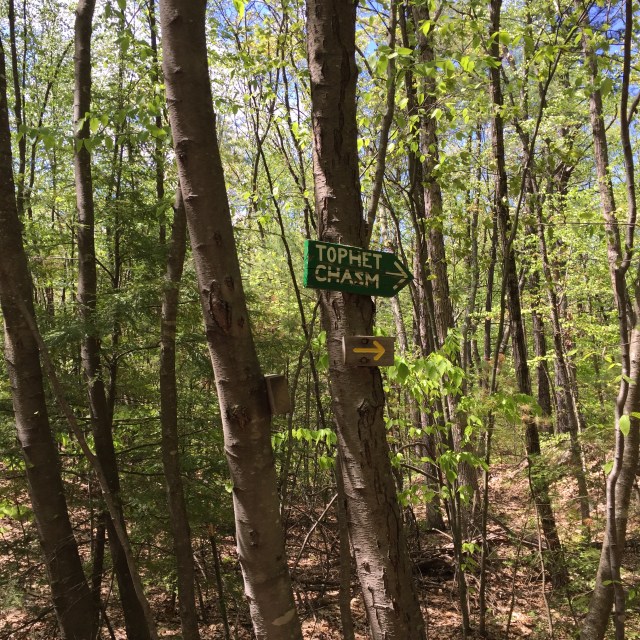
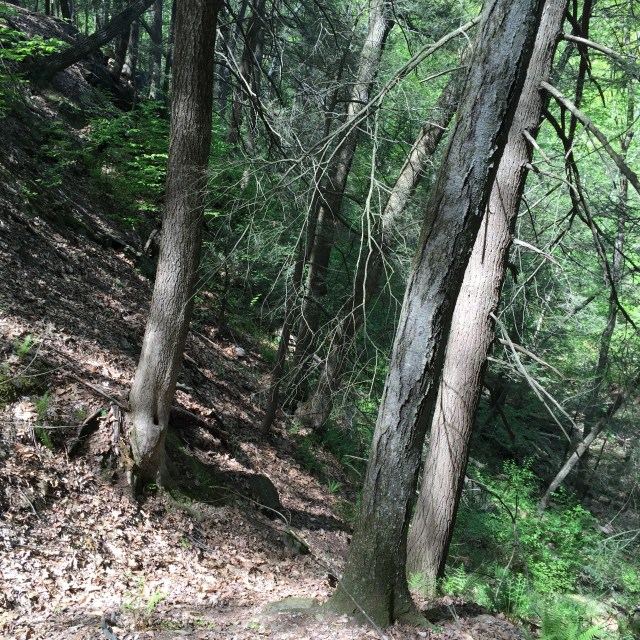
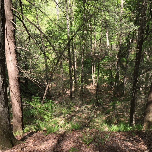
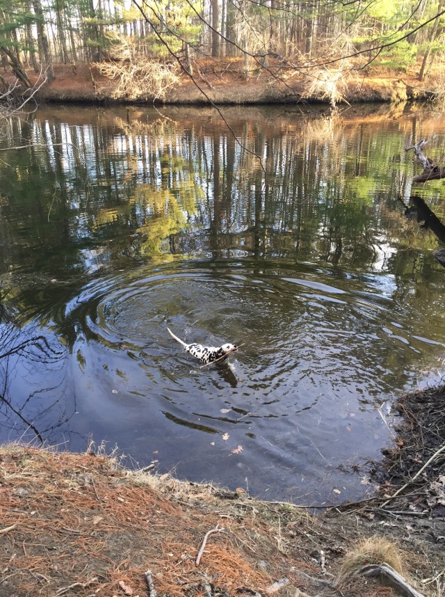
After being sick with allergies and some flu like symptoms last week, I attacked this weekend with a vengeance! Sunday I ran my first 5k road race with my sister, Brenda, in Stow MA. It was the 18th annual Run for the Woods, and the money raised benefits the Stow Conservation Trust. The course had minimal hills, and winds by some beautiful spots- an apple orchard, a farm with goats/cows, and a farm with sheep! That afternoon I was tired, but we had to do something with the pup, so we decided to try out the Oak Hill Conservation Area in Littleton, MA. The two big features there are the Lookout Rock, which I guess you can see the Hancock tower in Boston from on a clear day (it wasn’t that clear for us), and Tophet Chasm. Tophet Chasm was formed 15,000 years ago by an outlet from Lake Nashua, a glacial lake. There are trails along the ridge of the chasm looking down into it, and then a trail along the bottom of the chasm. We will NEVER take the trail at the bottom again, Mizpah had a blast running through the swampy areas down there and honestly, I don’t think I have seen her that muddy ever!!
Walking uphill felt great after running a 5k earlier haha!!!View from Lookout RockHighest point in Littleton- 508′Farm/land boundary
Sidewall of the chasmTrail through the swampy bottom of the chasmAnother shot of the wall of the chasmLooking down into the chasm from the top of the ridgeThis picture doesn’t even do justice to how muddy Mizpah was because you can’t see her back legs really well, she was gross!
We will hopefully be heading up to do some hiking in NH this coming weekend, but it is fun to explore smaller local spots when we can’t get up there. This area had conflicting information posted about leashing your dog. The leash law for Littleton was posted, but then another sign said dogs needed to be on leash or under verbal command, and then yet another sign said dogs needed to be in sight and under verbal control and were not allowed to approach people or dogs unless invited. We did a mix of leash and off leash….if we heard people, we put her on the leash. When she got super gross, we put her on a leash so she wouldn’t be gross greeting people. It was pretty quiet there though, not a lot of people at all. We had such a nice weekend weather wise this past weekend. I hope it continues!
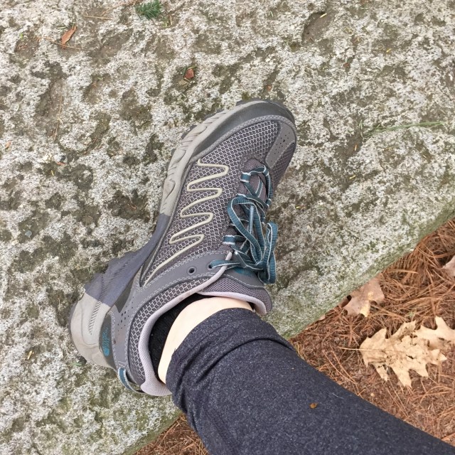
This entire week is gloomy and rainy here in Massachusetts so its a great time to dream about trail running and talk about my new trail running sneakers!! Dalmatians are very high energy dogs and they were bred to run alongside horse drawn carriages. They would run ahead and clear the crowds and then guard the goods when the men went inside. That’s why dalmatians are associated with firehouses and Budweiser, because firetrucks and the Budweiser trucks were originally horse drawn. What does that mean for someone who owns a dalmatian though? That means you are in the company of an animal that was bred to run miles and miles every day. Part of the reason why dalmatians got such a bad rep back when the dalmatian movies came out is because they are only good dogs with plenty of exercise. I once read that puppies can do 20k no problem. When we run on the trails, we do between 3-5 miles of hilly terrain…and she could totally do more. I love running with Mizpah in the woods, and I finally got my first pair of trail running sneakers about a month ago.
I got my North Face Ultra 109 Goretex sneaks from REI. We are members of the REI coop, so we had a $20 member dividend from when I bought my crampons last year, and a 20% coupon back on the member rewards weekend. The sneakers are $120, but I think I ended up paying $76. Great deal! They are not the best looking sneaker, gray and blue are a little boring, but they have great stability so I can run on rocks and roots without rolling my ankles, and they are goretex which means I am a little more protected in mud and puddles on the trail. I also got some new socks from LLBean for trail running because I wanted socks that weren’t so low cut.
Now, why get trail running sneakers? Can’t I just run on the trails with my normal running sneakers!?
You can! I did for years. I have noticed some huge improvements since I finally got some trail specific shoes though.
Running uphill- trails in MA are covered in dead leaves with roots and rocks underneath. Running uphill with my new sneaks which have awesome dirt biting treads is soooooo much easier. No more slipping back every step, or trying to navigate the trail to put my feet on non-slip ground.
Stability- these particular sneakers are made for stability so that when you are running over roots and rocks, it doesn’t impact your footfall as much. I roll my ankle and trip way less now.
Goretex- the first piece of clothing I owned with Goretex was my crew jacket and I have been in love ever since. My sneakers are able to go through mud and shallow puddles and my feet stay warm and dry.
A big rule that I have to follow with these sneakers is to only use the on the trails. Running on pavement in them would damage and wear down the amazing treads.
Thats my little Mizpah coming back to me after checking out an unfinished/abandoned beaver lodge. It was sorta a scary moment watching her traipse around on logs, but she has an explorer’s spirit that can’t be harnessed. We couldn’t hike this past weekend because of the rain….and its been raining all week so who knows about this weekend. Anyone have any fun Kentucky Derby plans!?
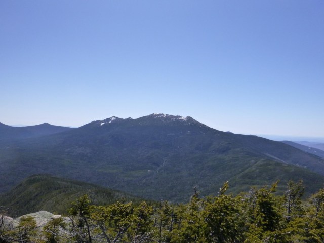
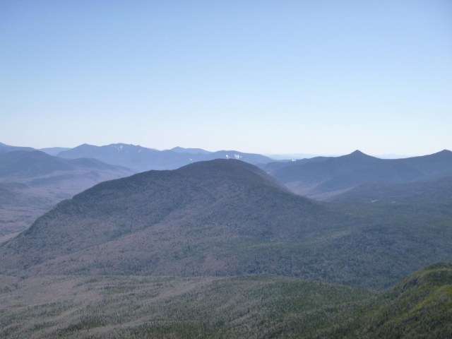
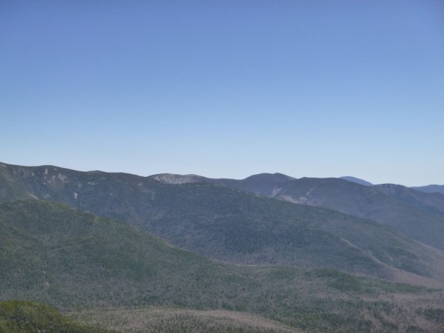
I hiked Mt. Garfield in December 2014, but we still aren’t quite ready to do any of the 9 remaining mountains I have left to finish the New Hampshire 48 4000 footers, so we did Mt. Garfield on Sunday for my husband’s grid. My husband, Jon, is doing the grid, which is all 48 in all 12 months. It takes years to accomplish for most; probably close to 20 years for Jon. When I did Garfield in December, we were socked in meaning it was a cloudy day with no views. When we did it Sunday there was not one cloud in the sky!!! Mt. Garfield is a part of the Franconia Ridge, so you can see Mt. Lafayette, Mt. Lincoln, Little Haystack, Mt. Liberty, and Mt. Flume to one side, and North & South Twin, and the Bonds to other side. You can look down into the Pemigewassett River Valley to see Owls Head, and on a really clear day, you can see Mt. Washington past the Bonds. We took the Garfield Ridge Trail up, which is a beautiful trail. The road to the trailhead from Rt 3 is still closed, so that does add 2 miles of walking to the distance. Overall I think it was 12 miles. There are a couple river crossings which were very low/safe for this time of year. Sometimes spring can be tough for river crossings because the melting snow makes for raging rivers. The trail was a sheet of ice for probably the last 2-3 miles to and from the summit. We had our microspikes, and even then it was a little tough. We both really wished that we had our crampons. We saw one couple turn around because they didn’t have any traction, another couple where one didn’t have traction and struggled hardcore, and another couple that shared 1 pair of microspikes (they each had one on their right foot). The happiest and safest folks had microspikes 🙂
Water levels are so low right now for spring, rock hopping across!Icy trails!Mizpah making it look easy!View of Mt. Lafayette, Mt. Lincoln, Little Haystack, Mt. Liberty, and the side of Mt. Flume from the center out to the leftCold n windy day! Owls HeadA river runs through it: The Pemi River ValleyFoundation of the tower that used to be on Mt. GarfieldSouth and North TwinThe Bonds behind the Twins
Mizpah did an amazing job as usual. She is so athletic, surefooted, and agile. I am constantly impressed by Mizpah out on the trails. She’s so aware of her surroundings and just in tune with the trails. We purposely let her nails stay a little long in the winter/spring until the ice melts because they give her little microspikes of her own. She was the only dog we saw up there, and she got a lot of love from our fellow hikers. This coming weekend, we are planning to do Mt. Cabot, which I do need for my 48, so I am really excited about that!!!
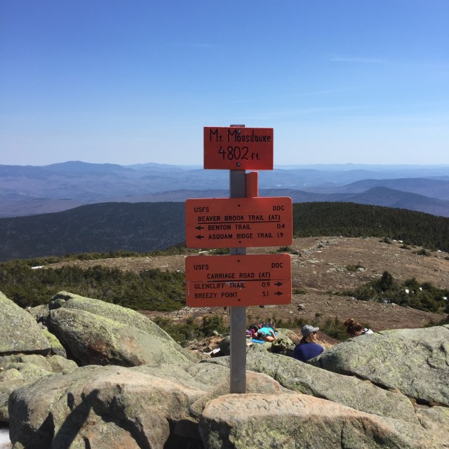
Sunday of this past weekend, my husband Jon, Mizpah, and I headed up to NH for a hike. Jon’s broken toe had healed just in time for our wedding, and we were ready to get back to hiking after almost 2 months away from our favorite mountains. We chose Mt. Moosilauke after reading through Saturday’s trip reports because Mt. Moosilauke had just some soft snow/ice on the Carriage Road trail where some of the mountains still require crampons. The Carriage Road trail is wide and gradual, it was a little over 10 miles and took us a little over 6 hours to do.
At the summit of Mt. Moosilauke, there are remains of the Prospect House built in 1860, later known as the Tip Top House, a hotel similar to the one on the summit of Mt. Washington. It burned down in 1942. The Carriage Road was built in 1870 to bring guests up to the summit.
Tip Top House, Moosilauke Breezy Point, NH
Breezy Point Road leads to the Carriage Road trailhead. Nathaniel Merrill built a farmhouse there in 1834, and converted the farmhouse in 1860 to serve as an inn called the Merrill Mountain Home. Slightly downhill from there, the larger Breezy Point House was built in 1877. It was destroyed by a fire in 1884, and then the Moosilauke Inn was built there in 1886. In 1915, the Merril Mountain burned down, and in 1953, the Moosilauke Inn burned down.
A smaller motel was built at the inn site which closed in 1981. Crazy history. The spot where the inn was is just a big field. I guess there was even a 9 hole golf course there around 1900. We did find a cellar hole around where the Merrill house could have been.
Then on our way out, we found this cellar hole further downhill from where the inn would have been. Could have been outbuildings from the original Breezy Point House.
Here are some more pictures from our hike. We did Moosilauke back in November too, and in this post, I discuss the link between Moosilauke and Dartmouth College.
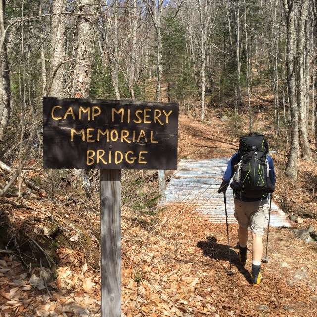
Built in the 1990s by the Dartmouth Outing Club, just beyond this bridge there was a shelter called Camp Misery in the 1930s. I believe the bridge is made of pieces of the shelter.Soft snow and ice on the trailMizpah and Jon on our way to the summit, South Peak in the background
Up on the summit, windy as usual!
View of Loon’s south peakMoosilauke’s summit is always windy, it is the first tall peak that gets wind from Vermont!
Beautiful birches on the trailMizpah relaxing when we got back to the car
So now I have done Moosilauke 3 times. Its great because there are so many different trails up and down it, I have never done it the same way twice. We are going to try to hike the next couple weekends and we have some big hiking plans for this summer. I still have 9 left to complete the 4000 footers in NH. Of course they are all tough, long, or far away hikes- save the craziest for last? I read this article this past week, and it really summed it all up for me. Where do you like to hike!? I love hearing other people’s hiking stories!!
I am so excited that the weather is getting warm and with the lack of snow, we have kinda skipped mud season! Woo! Now I am not sure how this will affect us moisture wise, like if we will have a bit of a drought without all that snow melt, but I can’t help but be excited to get out and run on the trails!!
Here are some pictures from our runs lately!
One muddy pup, comin right up!This is an adorable little sitting area to pause and enjoy nature 🙂
Mizpah and me are so much happier when we can get out and run on the trails together. I need new trail running sneakers though!! Any recommendations from anyone??
I would love gore tex but the price of trail running shoes is up there! I try to remind myself that these are my feet, ankles, knees….and its worth it. I will certainly be keeping my eyes open for deals!